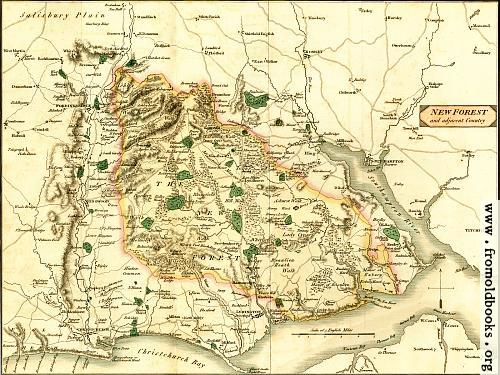
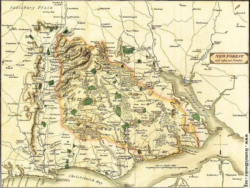
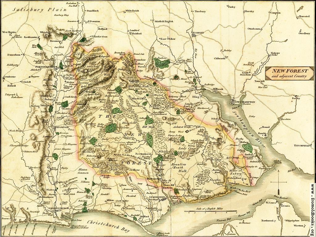
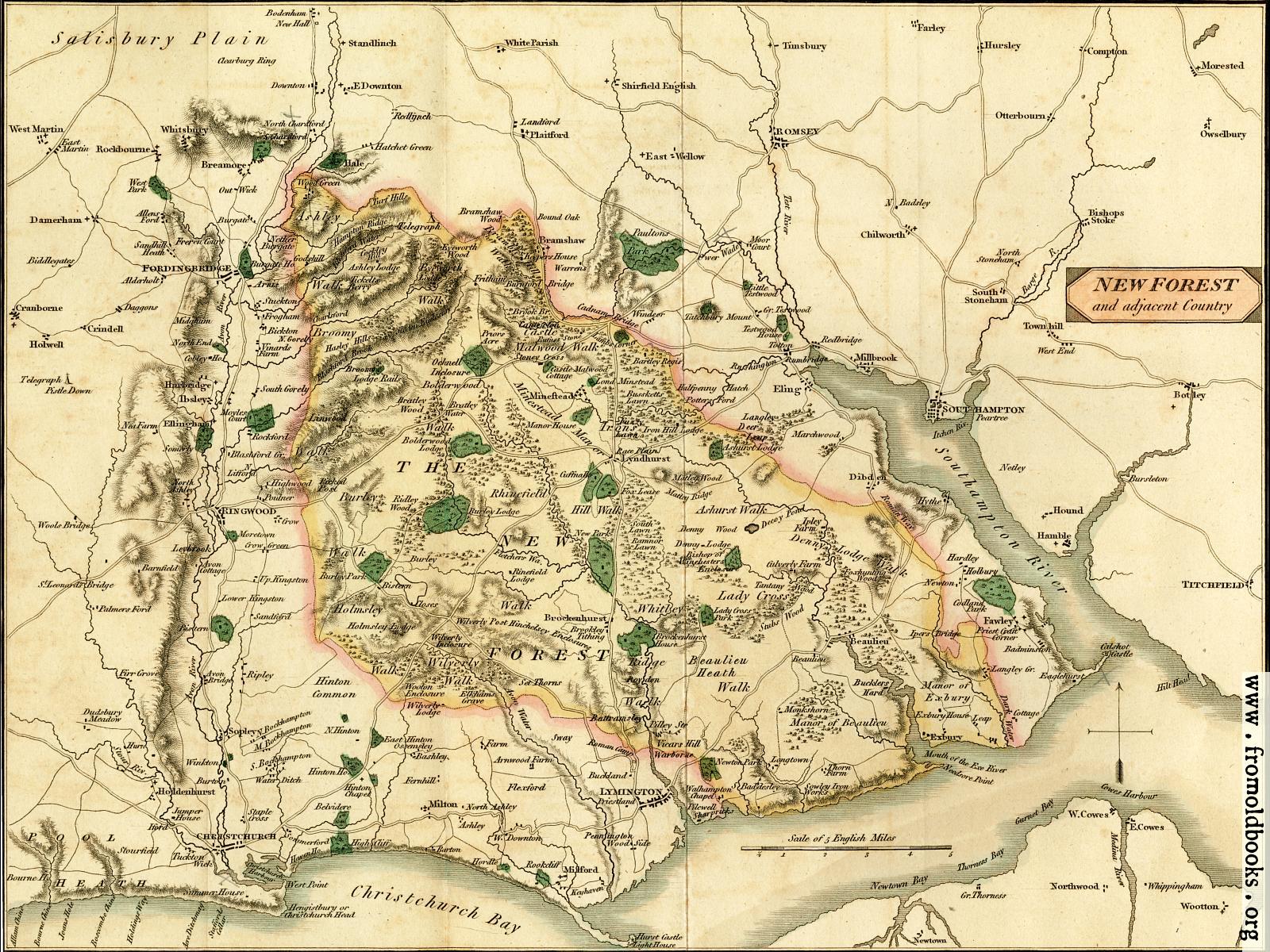
Map of the New Forest and Adjacent Countrydetails

[Picture: Map of the New Forest and Adjacent Country]
previous image
up
624115_300x250 Hang out in an empty Sistine Chapel

Map of the New Forest and Adjacent Country, in New Forest, Hampshire, England more

maps, colour, forests, wallpaper, backgrounds

foreground: none
background: none

Image title: Map of the New Forest and Adjacent Country
Source: Lewis, Percival Esq., F.A.S.: “Laws and History of the New Forest” (1811)
Place shown: New Forest, Hampshire, England
Keywords: maps, colour, forests, wallpaper, backgrounds
Status: out of copyright (called public domain in the USA), hence royalty-free stock image for all purposes usage credit requested
Please do not redistribute without permission, since running this site is expensive.
Share/Bookmark Arts Blogs - Blog Top Sites

Map of the New Forest and surrounding area, published in 1811; it shows Christchurch Bay and the Southampton River to the South, Titchfield and Owselbury to the East, Christchurch and Cranborne to the West, going up to the edge of Salisbuty Plain and Standlinch in the North. The map is more or less centred on Lyndhurst and Brockenhurst.

The map folds out (you can see the fold) and is delicately coloured.

Filename: 002-Map-of-the-New-Forest-q75-500x375.jpg
Scanner dpi: 1200
Unmarked: You can get a version of this image without the watermark at the lower right corner by requesting it in using the comment link below. The images are watermarked to help people find where they came from if they get reposted to blogs or other sites. Images under 1200 pixels on a side are still free, although I will ask for a donation :-)
Comment: Add a link, leave a comment or change keywords

$Id: mkgallery,v 1.27 2012/09/03 22:34:40 liam Exp liam $

Valid XHTML 1.0! Valid CSS!