This site may be going away; please consider the Donate link above... or LiberaPay:

A huge thank you to all who donate; 2026 Q3 Web hosting $52.02 / $300.
This site may be going away; please consider the Donate link above... or LiberaPay:
A huge thank you to all who donate; 2026 Q3 Web hosting $52.02 / $300.
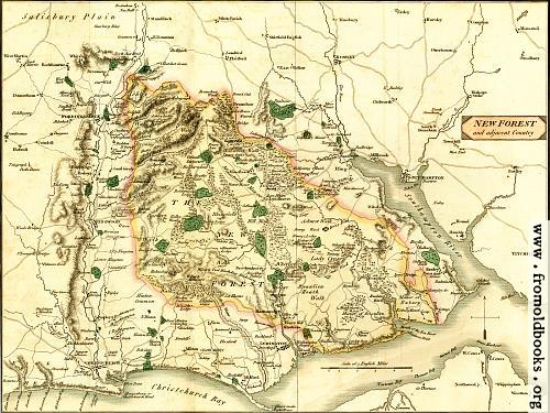
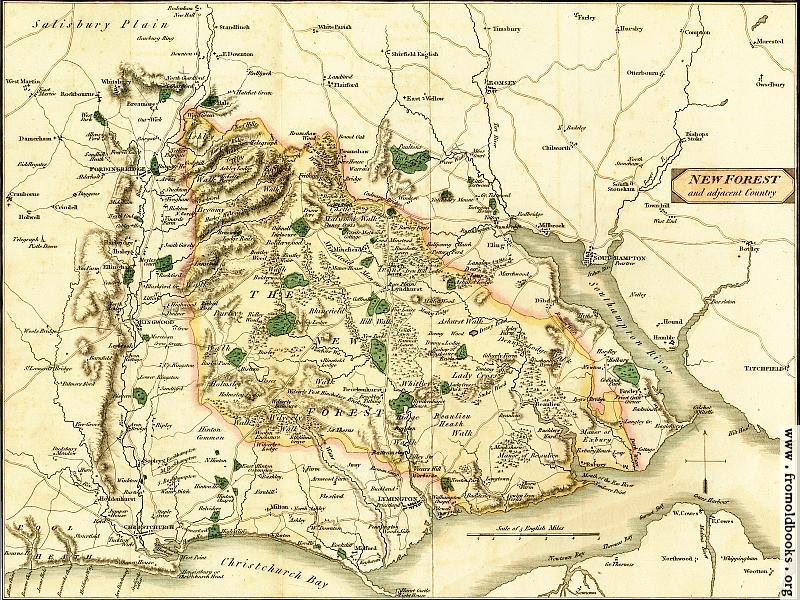
![[Picture: Map of the New Forest and Adjacent Country]](https://www.fromoldbooks.org/Lewis-LawsOfTheNewForest/pages/002-Map-of-the-New-Forest/../../tn/002-Map-of-the-New-Forest-q75-500x375.jpg "[Picture: Map of the New Forest and Adjacent Country]")
Buy print-size file for commercial or other use
| 500x375 | 60K | jpg free download |
| 120x90 | 4K | jpg free download |
| 267x200 | 17K | jpg free download |
| 800x600 | 152K | jpg free download |
| 1024x768 | 224K | jpg free download |
| 1600x1200 | 482K | jpg free download |
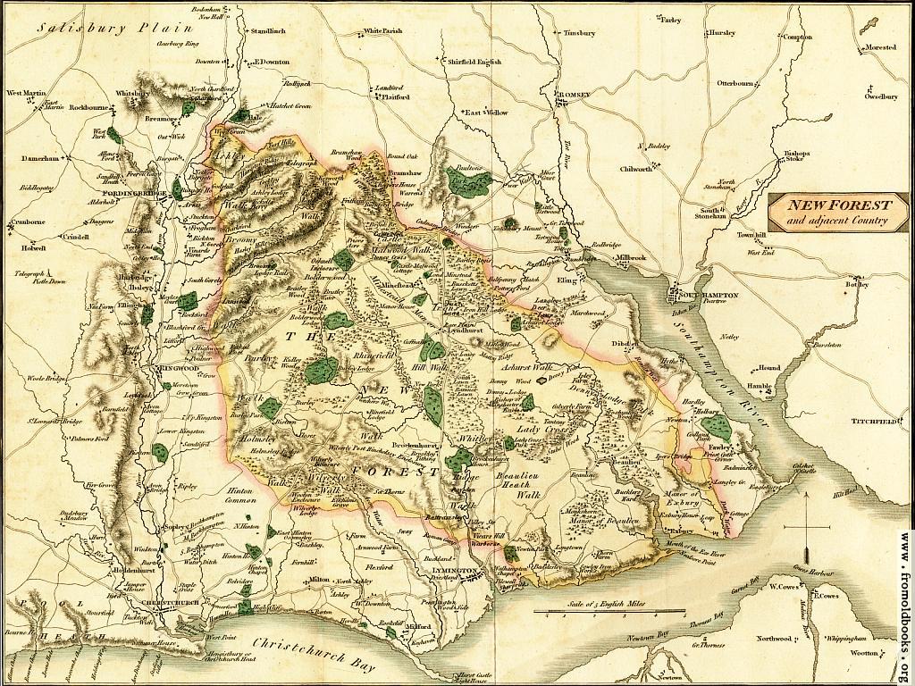
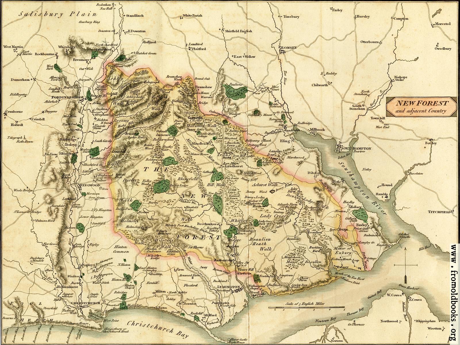
Map of the New Forest and Adjacent Country, in New Forest, Hampshire, England more
Map of the New Forest and surrounding area, published in 1811; it shows Christchurch Bay and the Southampton River to the South, Titchfield and Owselbury to the East, Christchurch and Cranborne to the West, going up to the edge of Salisbuty Plain and Standlinch in the North. The map is more or less centred on Lyndhurst and Brockenhurst.
The map folds out (you can see the fold) and is delicately coloured.