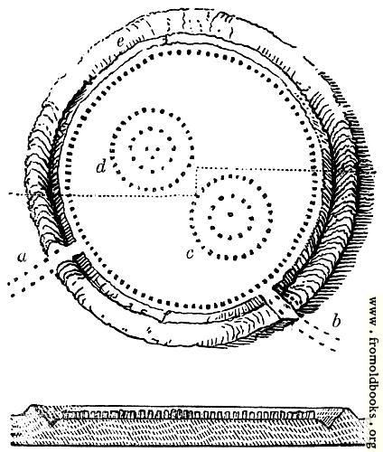
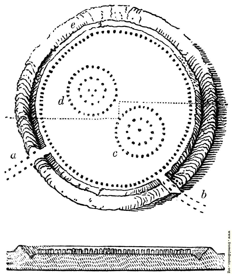
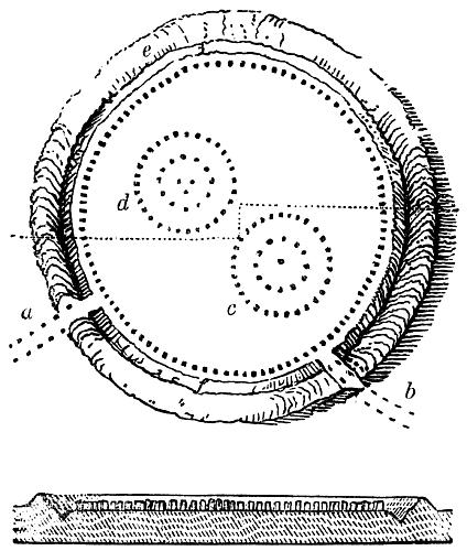
26.—Abury Plan and Sectiondetails

[Picture: 26.—Abury Plan and Section]
previous image
up

Image title:

26.—Abury Plan and Section

Taken from

Status:

Out of copyright (called public domain in the USA), hence royalty-free stock image for all purposes usage credit requested
Please do not redistribute without permission, since running this site is expensive.

Notes:


An 1840s plan of Avebury stone circle.

The plan exhibits this bank, e, with the ditch f: immediately within the ditch was a circle of stones, dotted on the plan. This circle is stated to have been composed of a hundred stones, many from fifteen to seventeen feet [approx. five or six metres] in height, but some much smaller, and others considerably higher, of vast breadth, in some cases equal to the height. The distance between each stone was about twenty-seven feet [approx seven metres]. The circle of stones was about thirteen hundred feet in diameter. The inner slope of the bank measured eighty feet. Its circumference at the top is stated by Sir Richard Hoare to be four thousand four hundred and forty-two feet. The area thus enclosed exceeds twenty-eight acres. Half-way up the bank was a sort of terrace walk of great breadth.

Get unwatermarked version
Buy print-size file for commercial or other use

424x500 45K jpg free download
120x141 5K jpg free download
170x200 9K jpg free download
693x817 94K jpg free download
924x1089 135K jpg free download
1848x2178 292K jpg free download

Similar images: