This site may be going away; please consider the Donate link above... or LiberaPay:

A huge thank you to all who donate; 2026 Q3 Web hosting $52.02 / $120.
This site may be going away; please consider the Donate link above... or LiberaPay:
A huge thank you to all who donate; 2026 Q3 Web hosting $52.02 / $120.
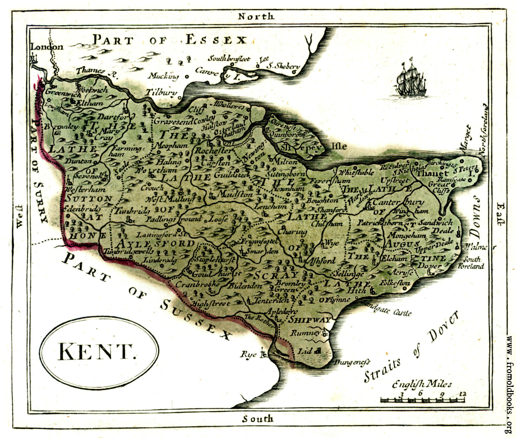
![[Picture: Antique map of Kent]](https://www.fromoldbooks.org/Grose-Antiquities-VolIII/pages/003-Antique-Map-of-Kent/003-Antique-Map-of-Kent-q75-663x563.jpg "[Picture: Antique map of Kent]")
Buy print-size file for commercial or other use
| 500x425 | 70K | jpg free download |
| 120x102 | 5K | jpg free download |
| 235x200 | 16K | jpg free download |
| 663x563 | 124K | jpg free download |
| 884x751 | 196K | jpg free download |
| 1767x1501 | 507K | jpg free download |
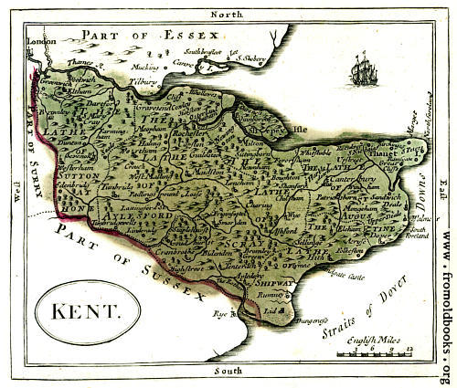
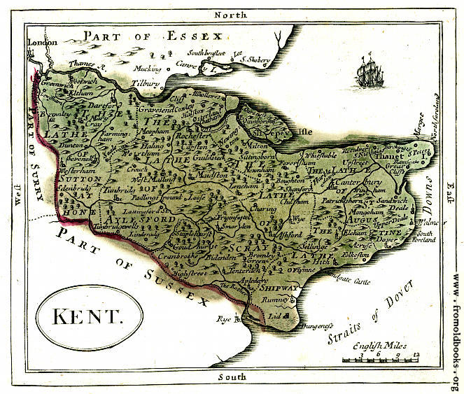
This map of Kent was published in 1783; it shows, in the Lathe of Sutton, Woolwich, Greenwich, Eltham, Lewisham, Brownley, Dartford, S. Mary Cray, Dunton, Farmingham, Sevenoke [Sevenoak], Westerham. Sutton, Edenbridg [Edenbridge]; in the Lathe of Aylesford, Allhollowes, Cliff, Gravesend, Cowley, Halstow, Osterland Chatham, Meopham, Haling, Wortham, Crouch, West Malling, Tunbridg [Tunbridge], Padlings pounf, Lattingford St., Tunbridgewells [Tunbridge Wells], Linderadg, Rochester, Capston, Guildsted, Maidston, Leneham, Loose; in the Lathe of Scray, Newington, Milton, Sittingborn, Newnham, Feversham, Boughton, Shanford, Chilham, Charing, Wye, Ashford, Friginfastel, Smarden, Staplehurst, Goudhurst, Cranbrooke, Bidenden, Highstreet, Bromley Greene, Tenterden, Apledore, and The Rother [river]; in Sliepey Isle, Shireness, Quinborough; in the Lathe of St. Augustine, Whitstable, Reculver, Upstreet, S. Nicholas, Burchington, Thanet I., S Peters, Marget, Northforeland, Ramsgate, Great Cliffs, Canterbury, Harble down, Windham, Patrickshorn, Sandwich, Deale, Mongeham, Upper Deale, Walme, South foreland, Dover; in the Lathe of Shipway, Elcham, Aeryse, Folkeston, Sellinge, Hith, Flynne, Sandgate Castle, Rumney, Dungeness, Lid.
I do not have higher versions of this image, sorry; my copy of the book is missing the maps, and I bought this scan from eBay. I do have the original scan, before I sharpened it and played a little with the colours.