This site may be going away; please consider the Donate link above... or LiberaPay:

A huge thank you to all who donate; 2026 Q3 Web hosting $52.02 / $300.
This site may be going away; please consider the Donate link above... or LiberaPay:
A huge thank you to all who donate; 2026 Q3 Web hosting $52.02 / $300.
![[Picture: Pembroke Castle (Plan)]](https://www.fromoldbooks.org/BartholomewsThoroughGuides-SouthWales/pages/157-Map-Pembroke-Castle/157-Map-Pembroke-Castle-q75-1697x1090.jpg "[Picture: Pembroke Castle (Plan)]")
Buy print-size file for commercial or other use
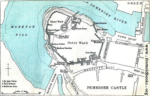
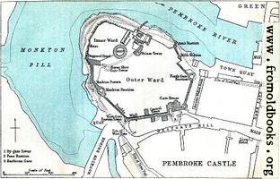
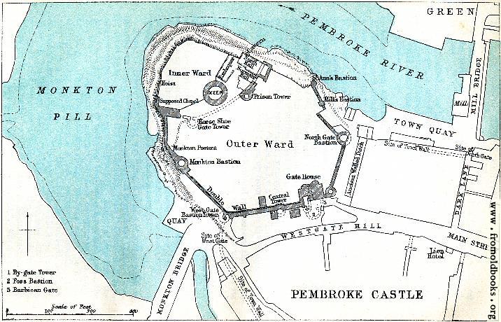
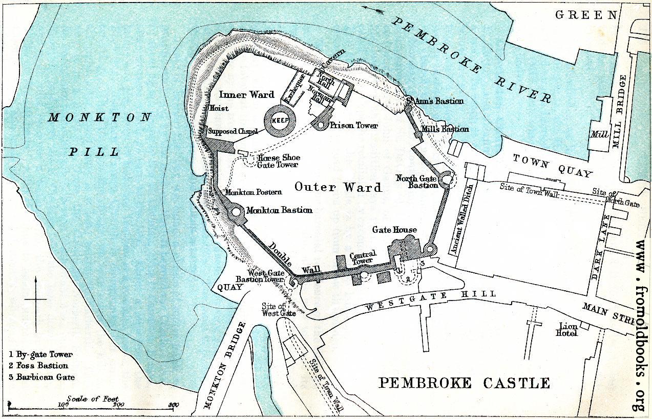
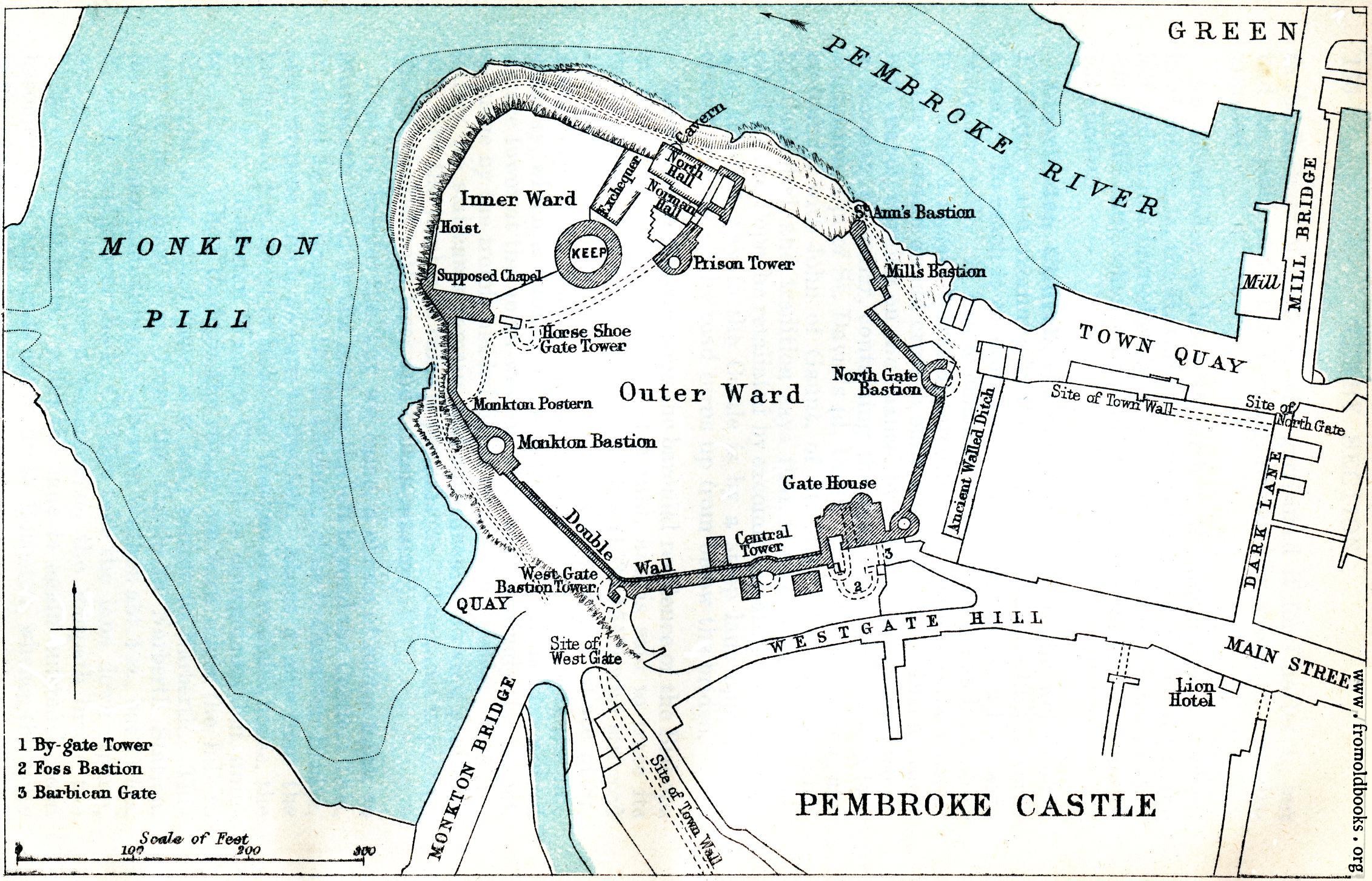
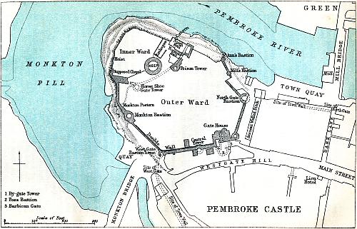
This plan appears to have been the one used by Charles Oman in his book of Castles that could be reached by the Great Western Railway. The main differences are that this one is printed in two colours, blue and black, and that his has the addition of the tennis courts.
The Castle (adm. 6d; key at the Saddler’s on the right just beyond the Lion Hotel) externally is one of the most striking ruins in the kingdom. Within, it is chiefly of interest to the antiquarian. [...] The annexed Plan (from the Ordnance map, with details kindly supplied by J. R. Cobb, Esq.) is intended to indicate the arrangements of the building when more or less intact and so to render the existing ruins intelligible.” (p. 157)
Get unwatermarked version
Buy print-size file for commercial or other use