This site may be going away; please consider the Donate link above... or LiberaPay:

A huge thank you to all who donate; 2026 August Web hosting: 0 / $35
This site may be going away; please consider the Donate link above... or LiberaPay:
A huge thank you to all who donate; 2026 August Web hosting: 0 / $35
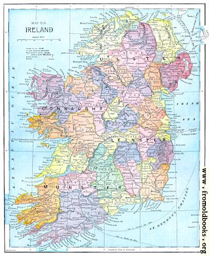
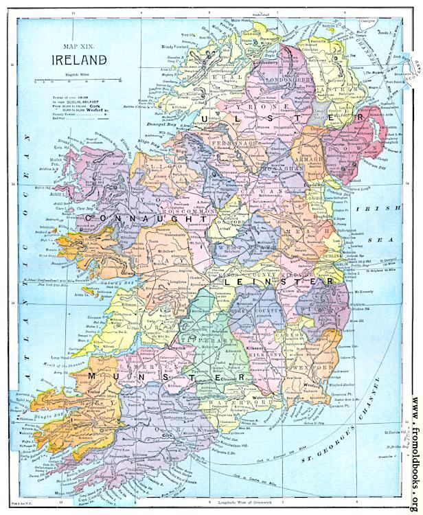
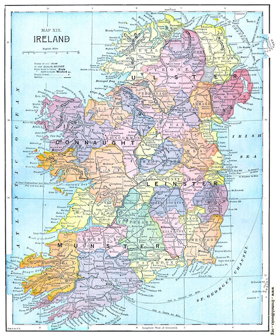
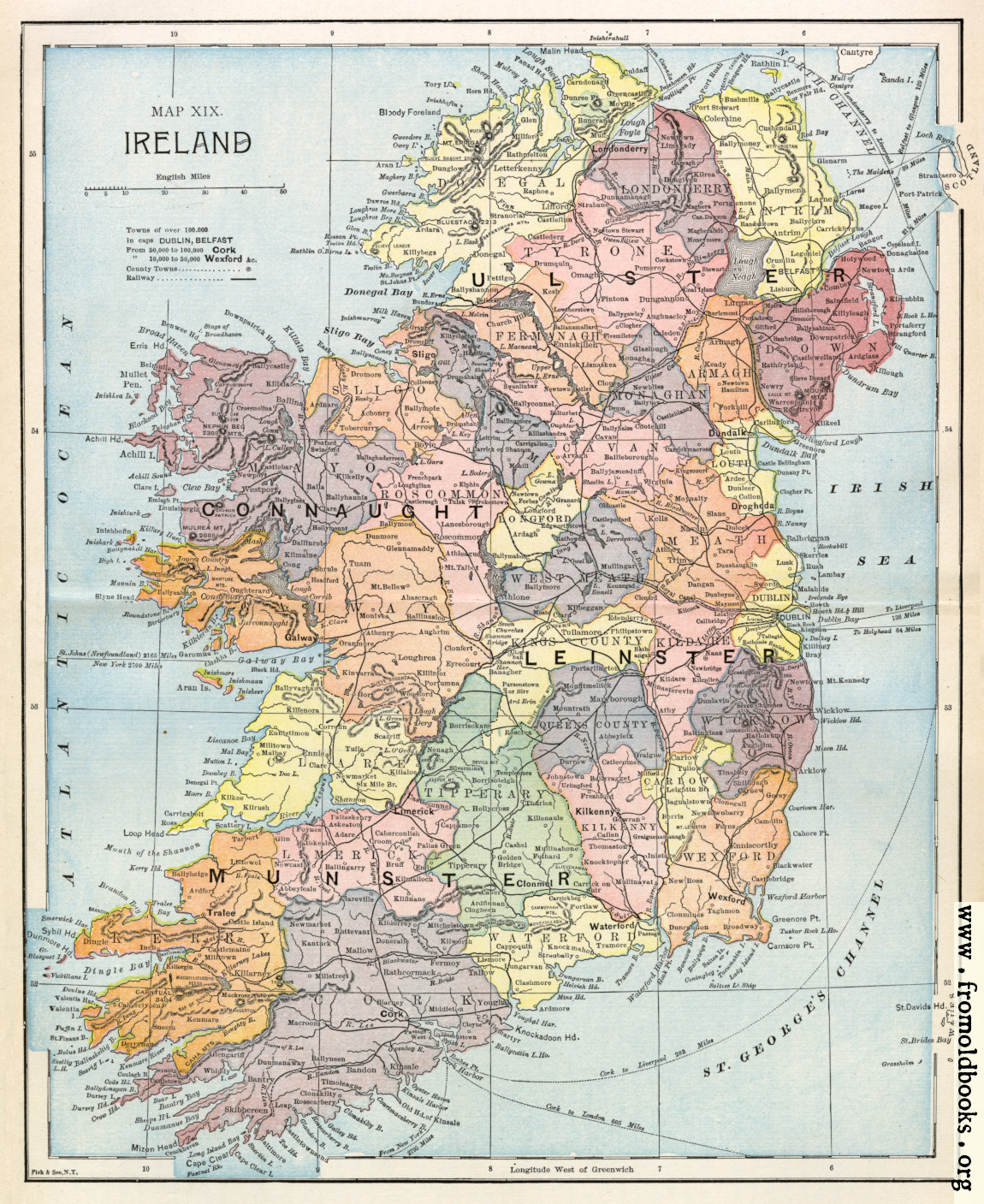
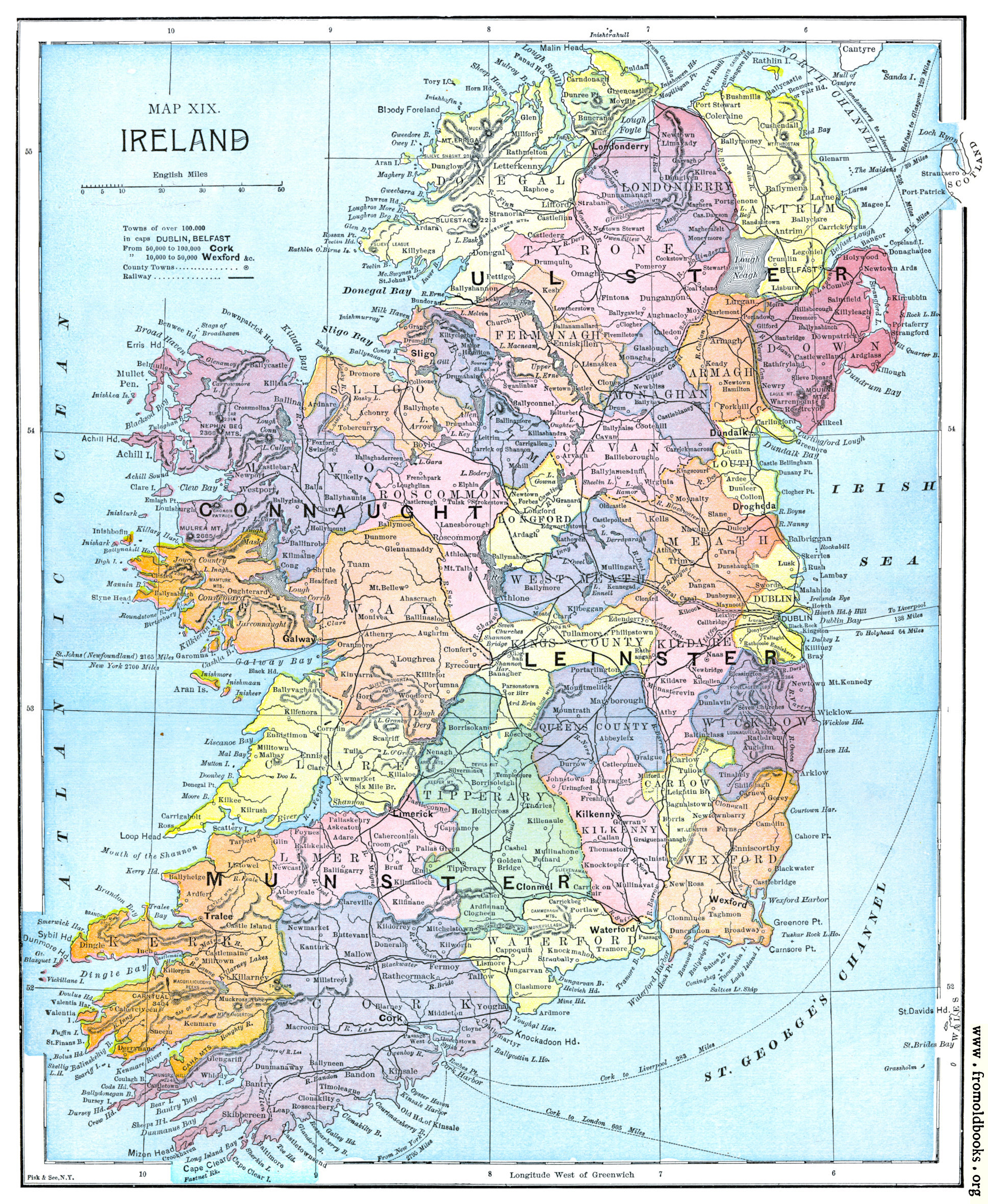
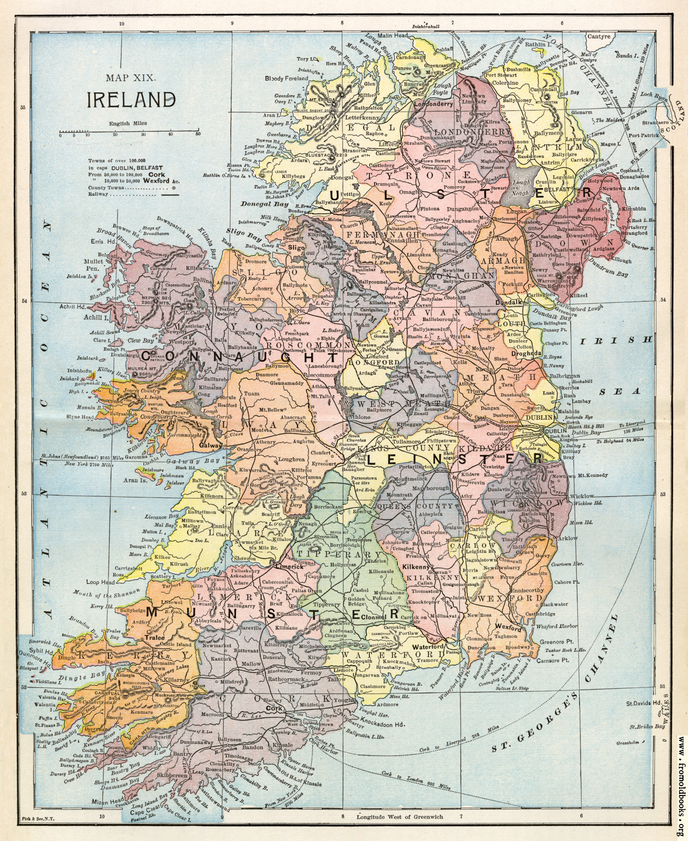
![[Picture: Map XIX. Ireland]](https://www.fromoldbooks.org/Ridpath-HistoryOfTheWorld-VolIII/pages/415-map-of-ireland/415-map-of-ireland-q85-969x1180.jpg "[Picture: Map XIX. Ireland]")
Buy print-size file for commercial or other use
A political map showing county boundaries, with counties in different colours, and Ulster, Connaught, Leinster, Munster labeled; railway are shown, and towns with more than 100,000 people are labeled in a sans-serif typeface.
This map predates the separation of Ireland into Northern Irelan and Eire in the early 1920s.
Get unwatermarked version
Buy print-size file for commercial or other use