This site may be going away; please consider the Donate link above... or LiberaPay:

A huge thank you to all who donate; 2026 Q3 Web hosting $52.02 / $300.
This site may be going away; please consider the Donate link above... or LiberaPay:
A huge thank you to all who donate; 2026 Q3 Web hosting $52.02 / $300.
![[Picture: Plan of Burgh Castle in Suffolk.]](https://www.fromoldbooks.org/Boswell-Antiquities/pages/266-Plan-of-Burgh-Castle-map/266-Plan-of-Burgh-Castle-map-q85-144x200.jpg "[Picture: Plan of Burgh Castle in Suffolk.]")
Buy print-size file for commercial or other use
| 361x500 | 61K | jpg free download |
| 120x166 | 7K | jpg free download |
| 144x200 | 8K | jpg free download |
| 523x723 | 200K | jpg free download |
| 697x964 | 311K | jpg free download |
| 929x1285 | 519K | jpg free download |
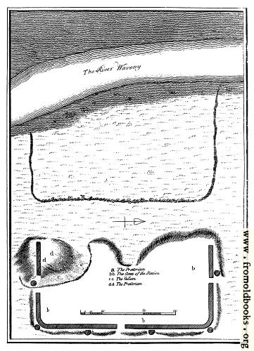
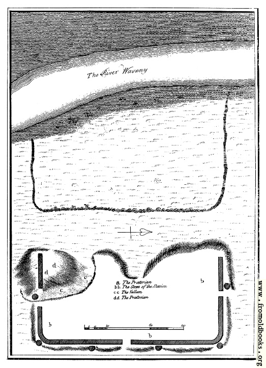
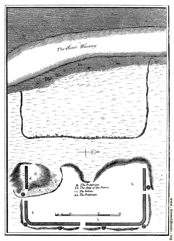
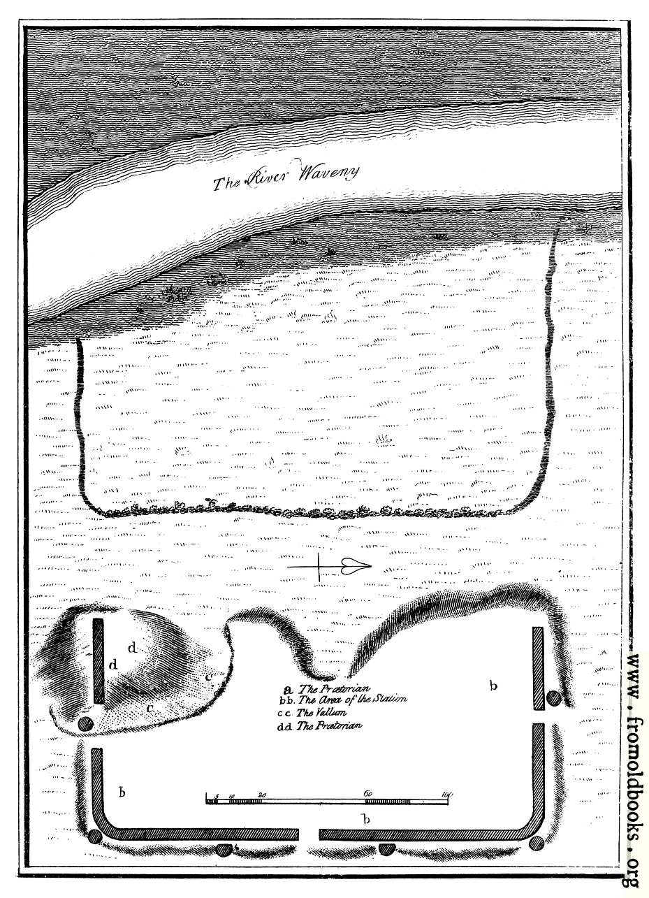
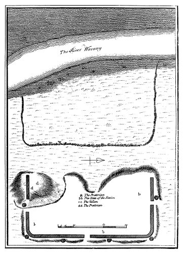
Plan of Burgh Castle in Suffolk., in Burgh Castle, Suffolk, England more
Burgh Castle is next to Breydon Water on the Norfolk/Suffolk border. It is (or was) a Roman fort, built in the 3rd century. The plan marks the locations of the Prætorian (by which it means the Prætorium, or the place in the fort where the commander lived); presumably the label in this map is conjectural. It also marks the area of the stadium.