| 500x349 | 74K | jpg free download |
| 119x83 | 4K | jpg free download |
| 287x200 | 20K | jpg free download |
| 813x568 | 183K | jpg free download |
| 1084x758 | 303K | jpg free download |
| 1446x1011 | 484K | jpg free download |
| 1927x1347 | 510K | jpg free download |
| Image title: | Map of New France |
|---|---|
| Source: | Holme, Charles: “Art in England During the Elizabethan and Stuart Periods” (1908) |
| Place shown: | Canada |
| Keywords: | maps, ships, whales, greyscale |
| Status: | stock image royalty-free for non-commercial uses only, usage credit required Please do not redistribute without permission, since running this site is expensive. |
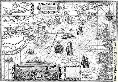
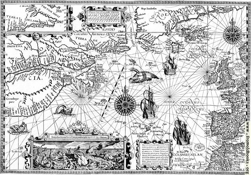
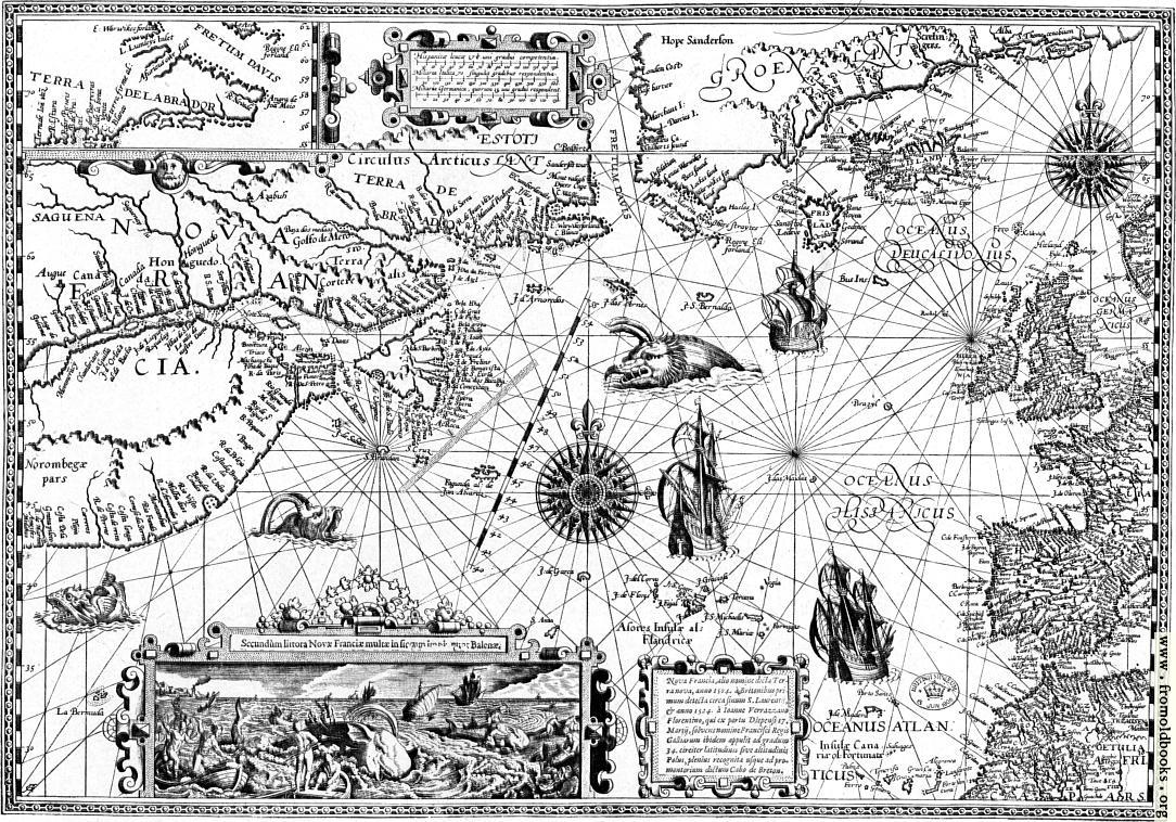
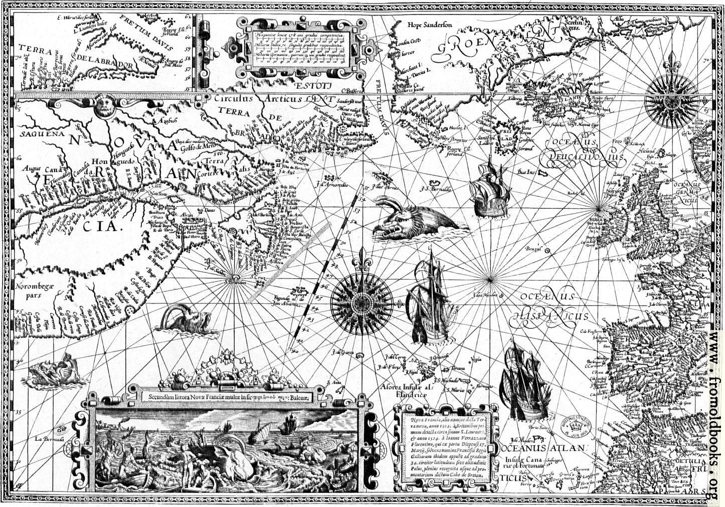
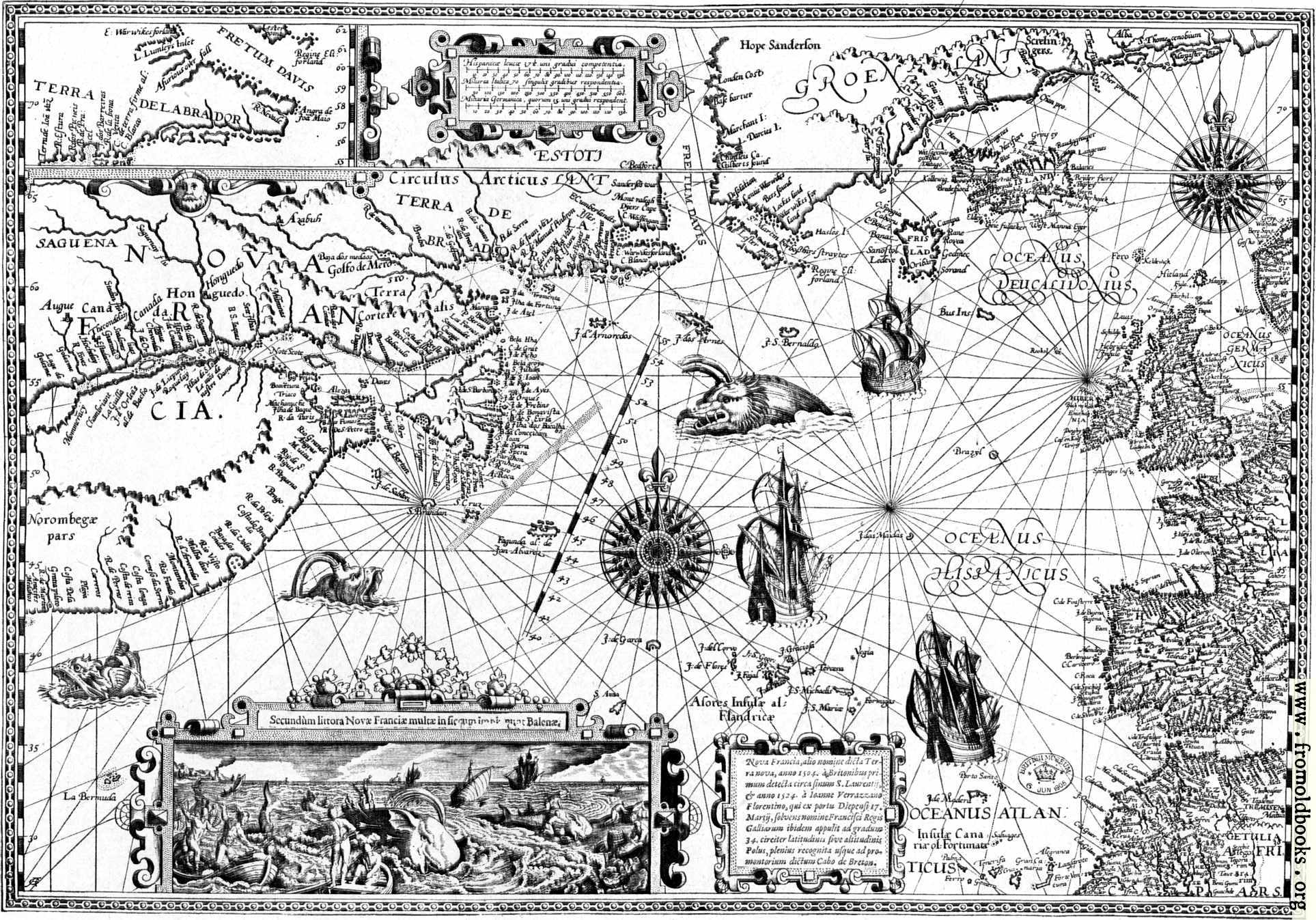
Map of “New France” (Canada). From the engraving by Benjamin Wright (circa 1608). “No maps [...] were better engraved or more individual in decorative embellishment than those of Benjamin Wright, whose Canada—or as it was then called, New France—with an inset picture of whale-fishing, is given on page 114 as a characteristic example of the geographic engraving of the period. (p. 109)” I have made a larger version of this antique map available than usual; I scanned the reproduction at 1200dpi. Please don’t link to the largest version of the image, though! |
|
| Dimensions: | 202 x 140mm (8.0 x 5.5 inches) |
| Filename: | 114-Map-of-New-France-q75-500x349.jpg |
| Blog image: | http://fromoldbooks.org/r/1f/114-Map-of-New-France-q75-500x349.jpg |
| Blog link: | http://fromoldbooks.org/r/1f/pages/114-Map-of-New-France/ |
| Scanner dpi: | 2400 |
| Unmarked: | You can get a version of this image without the watermark at the lower right corner by requesting it here; The images are watermarked to help people find where they came from if they get reposted to blogs or other sites. Images under 1200 pixels on a side are still free, although I will ask for a donation :-) |
| Comment: | Add a link, leave a comment or change keywords |