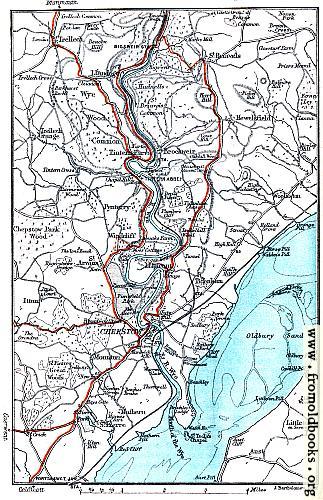
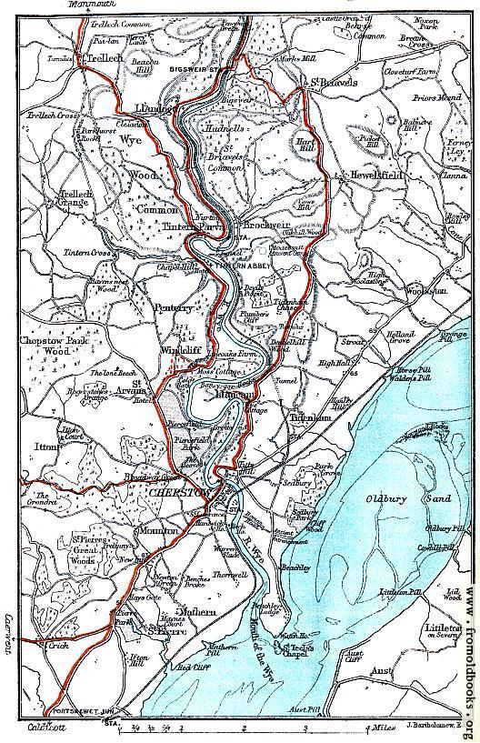
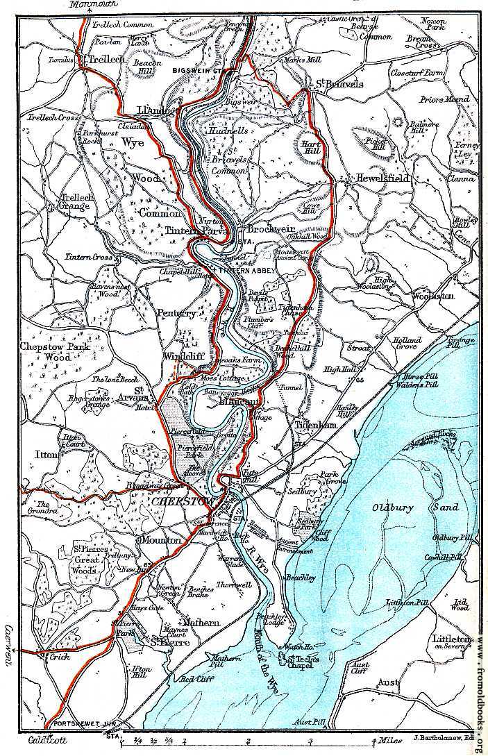
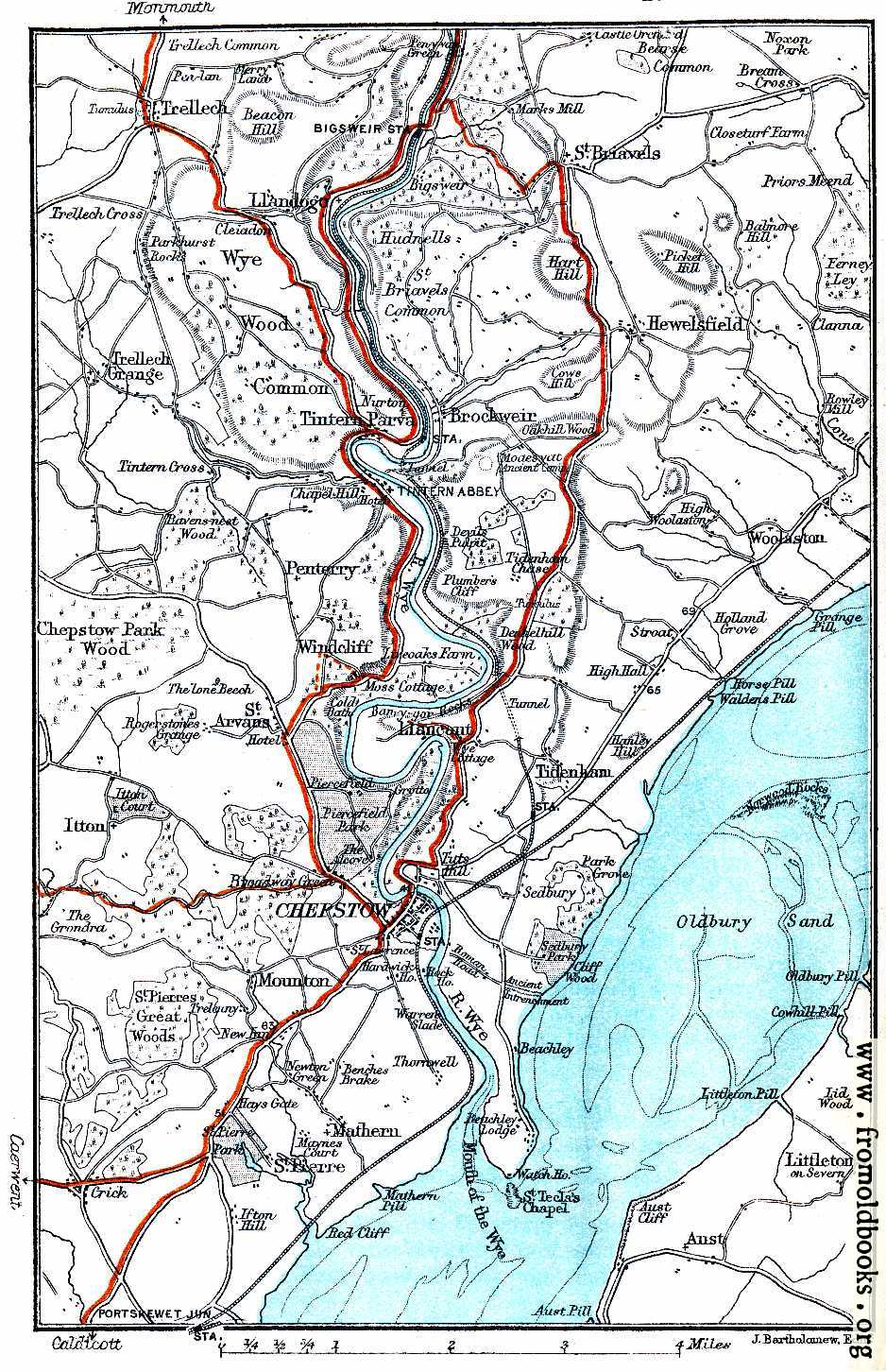
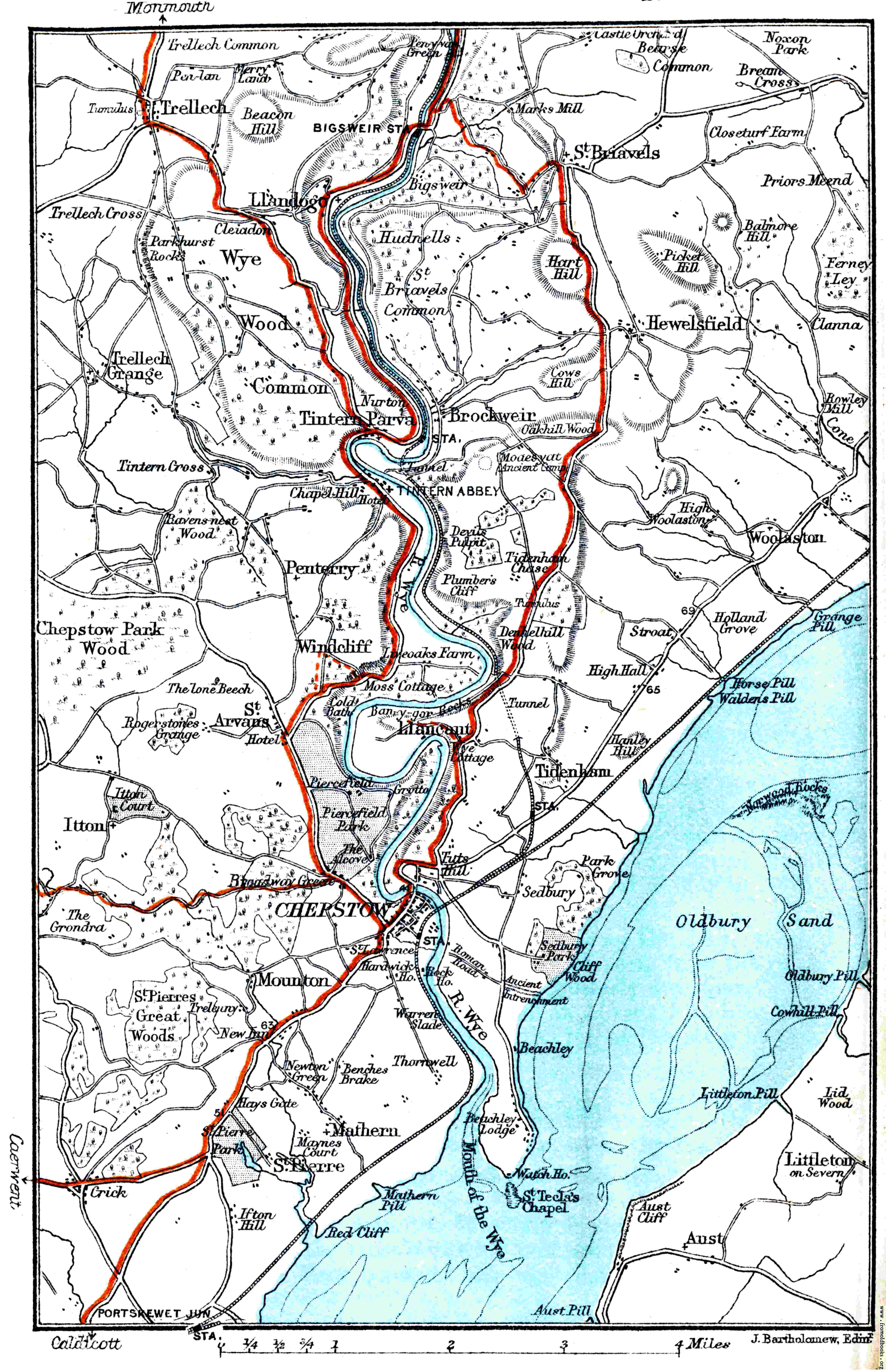
| 323x500 | 69K | jpg free download |
| 120x185 | 11K | jpg free download |
| 129x200 | 10K | jpg free download |
| 528x817 | 165K | jpg free download |
| 703x1089 | 196K | jpg free download |
| 938x1452 | 317K | jpg free download |
| 4689x7259 | 957K | jpg free download |
| Image title: | Map: River Wye, Chepstow, etc. |
|---|---|
| Source: | Ward, C. S. and Baddeley, B. A.: “South Wales and the Wye District of Monmouthshire” (1892) |
| Place shown: | Wales |
| Keywords: | maps, colour |
| Status: | out of copyright (called public domain in the USA), hence royalty-free stock image for all purposes usage credit requested Please do not redistribute without permission, since running this site is expensive. |
This old map covers the Wye valley from Trellech and Llandog in the North, through Brockweir and Tintern Parva wit Tintern abbey, down past Windcliff and Llancant into Chepstow and the Mouth of the Wye. |
|
| Filename: | 019-Map-River-Wye,-Chepstow-etc-q75-323x500.jpg |
| Blog image: | http://fromoldbooks.org/r/2e/019-Map-River-Wye,-Chepstow-etc-q75-323x500.jpg |
| Blog link: | http://fromoldbooks.org/r/2e/pages/019-Map-River-Wye,-Chepstow-etc/ |
| Scanner dpi: | 1200 |
| Unmarked: | You can get a version of this image without the watermark at the lower right corner by requesting it in using the comment link below. The images are watermarked to help people find where they came from if they get reposted to blogs or other sites. Images under 1200 pixels on a side are still free, although I will ask for a donation :-) |
| Comment: | Add a link, leave a comment or change keywords |