This site may be going away; please consider the Donate link above... or LiberaPay:

A huge thank you to all who donate; 2026 Q3 Web hosting $52.02 / $120.
This site may be going away; please consider the Donate link above... or LiberaPay:
A huge thank you to all who donate; 2026 Q3 Web hosting $52.02 / $120.
![[Picture: Map: River Wye, Chepstow, etc.]](https://www.fromoldbooks.org/BartholomewsThoroughGuides-SouthWales/pages/019-Map-River-Wye,-Chepstow-etc/../../tn/019-Map-River-Wye,-Chepstow-etc-q75-323x500.jpg "[Picture: Map: River Wye, Chepstow, etc.]")
Buy print-size file for commercial or other use
| 323x500 | 69K | jpg free download |
| 120x185 | 11K | jpg free download |
| 129x200 | 10K | jpg free download |
| 528x817 | 165K | jpg free download |
| 703x1089 | 196K | jpg free download |
| 938x1452 | 317K | jpg free download |
| 4689x7259 | 957K | jpg free download |
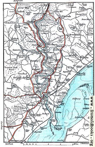
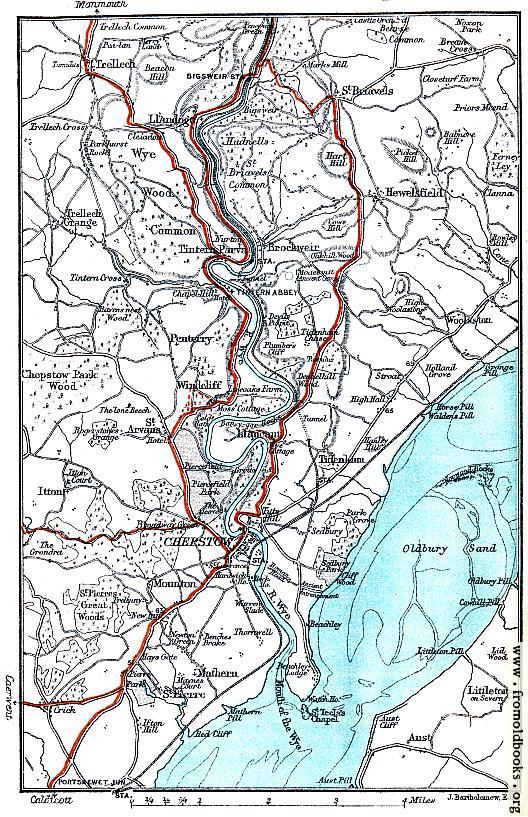
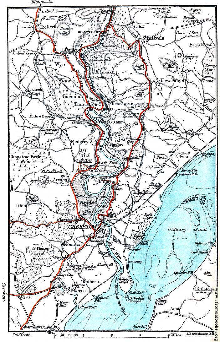
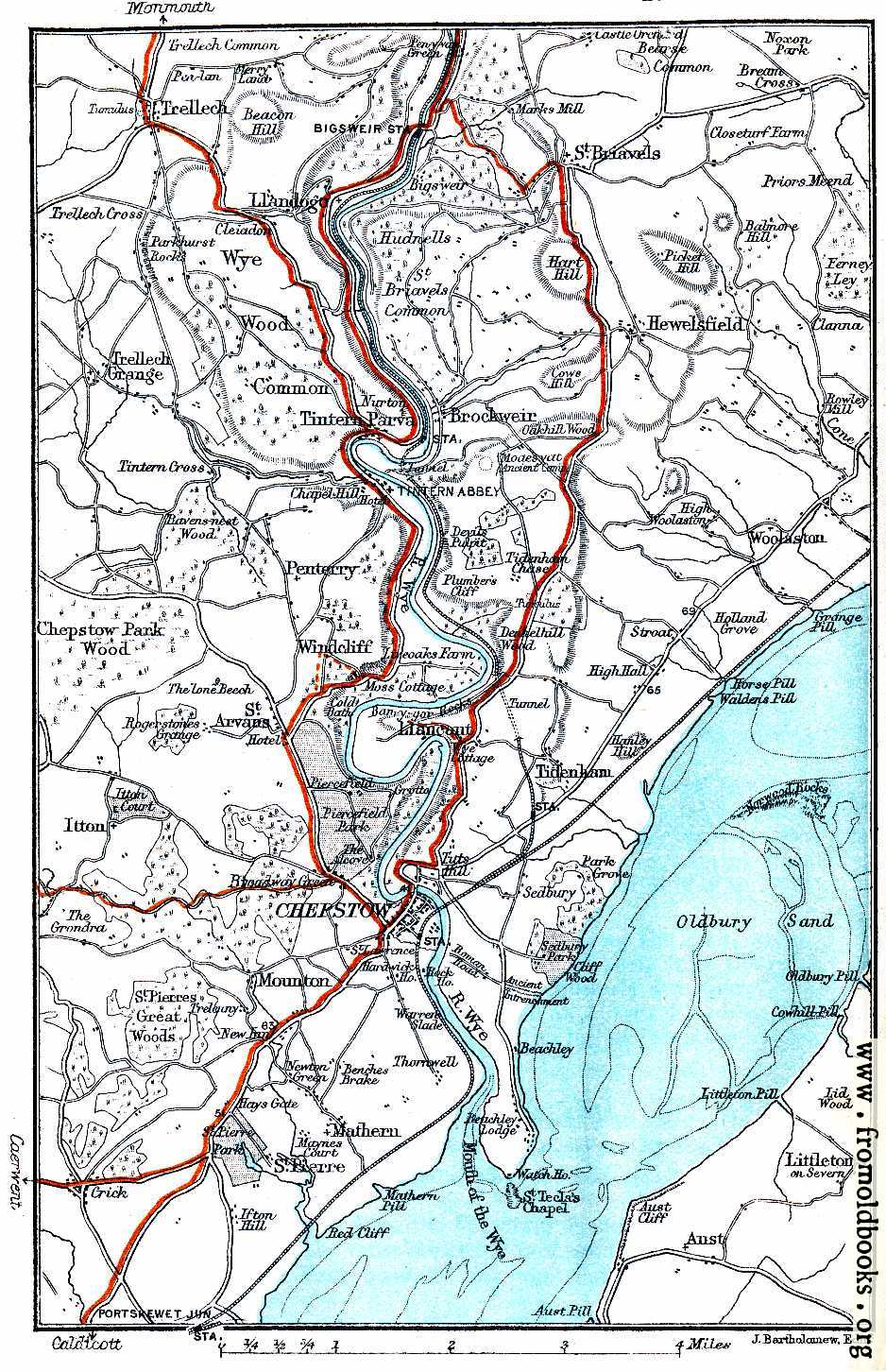
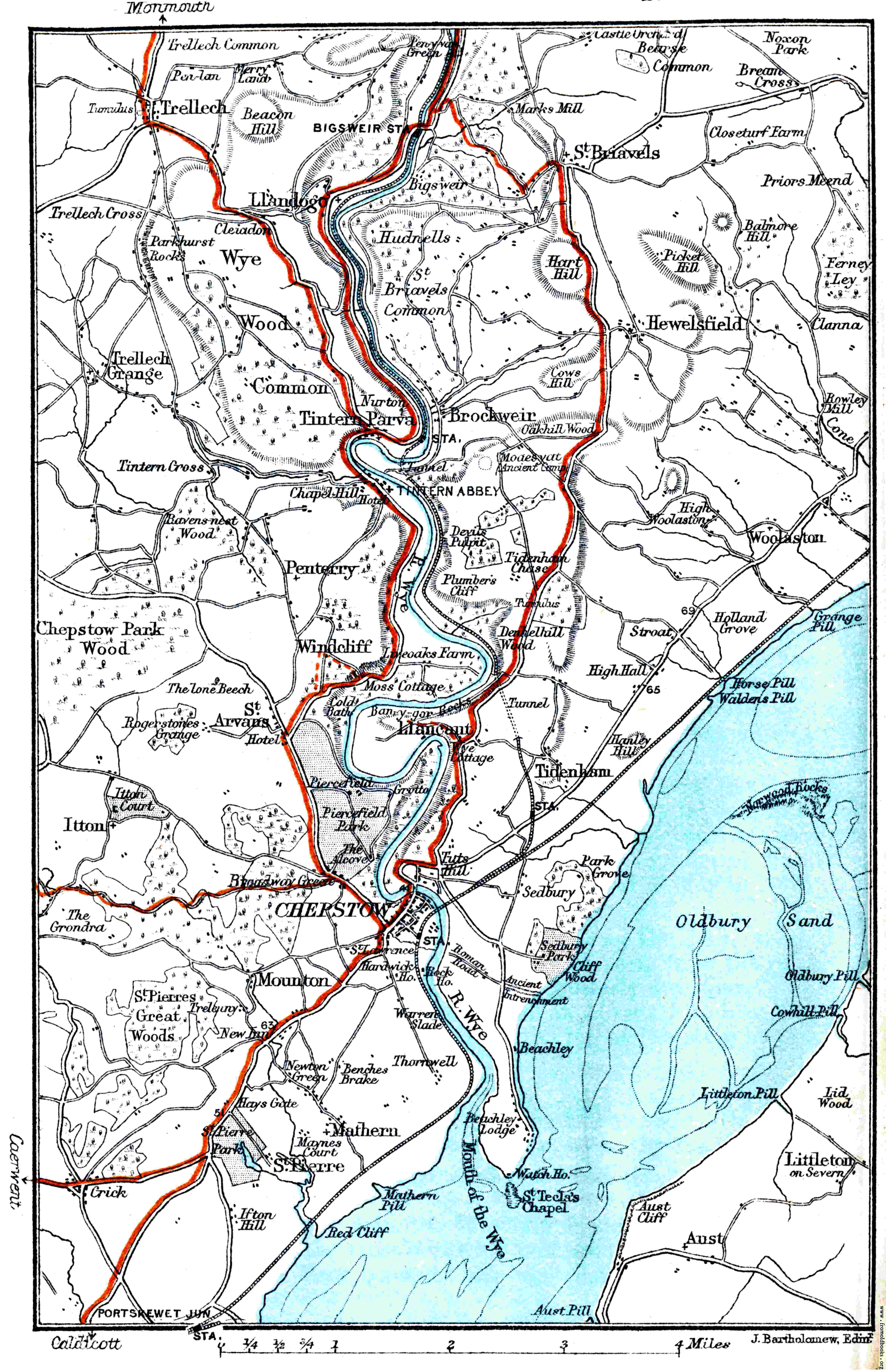
This old map covers the Wye valley from Trellech and Llandog in the North, through Brockweir and Tintern Parva wit Tintern abbey, down past Windcliff and Llancant into Chepstow and the Mouth of the Wye.