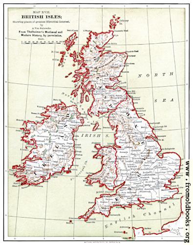
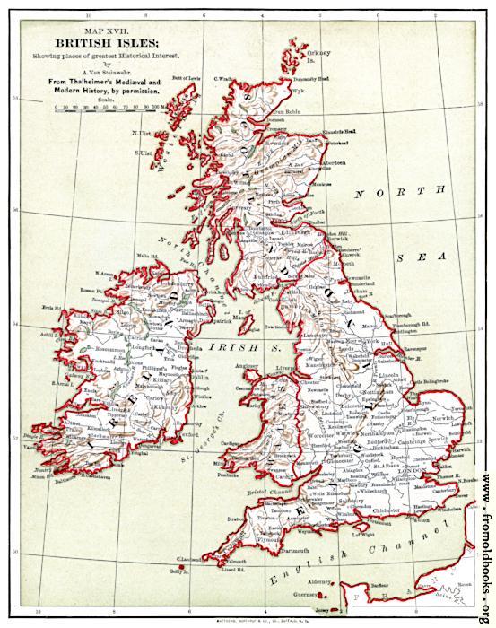
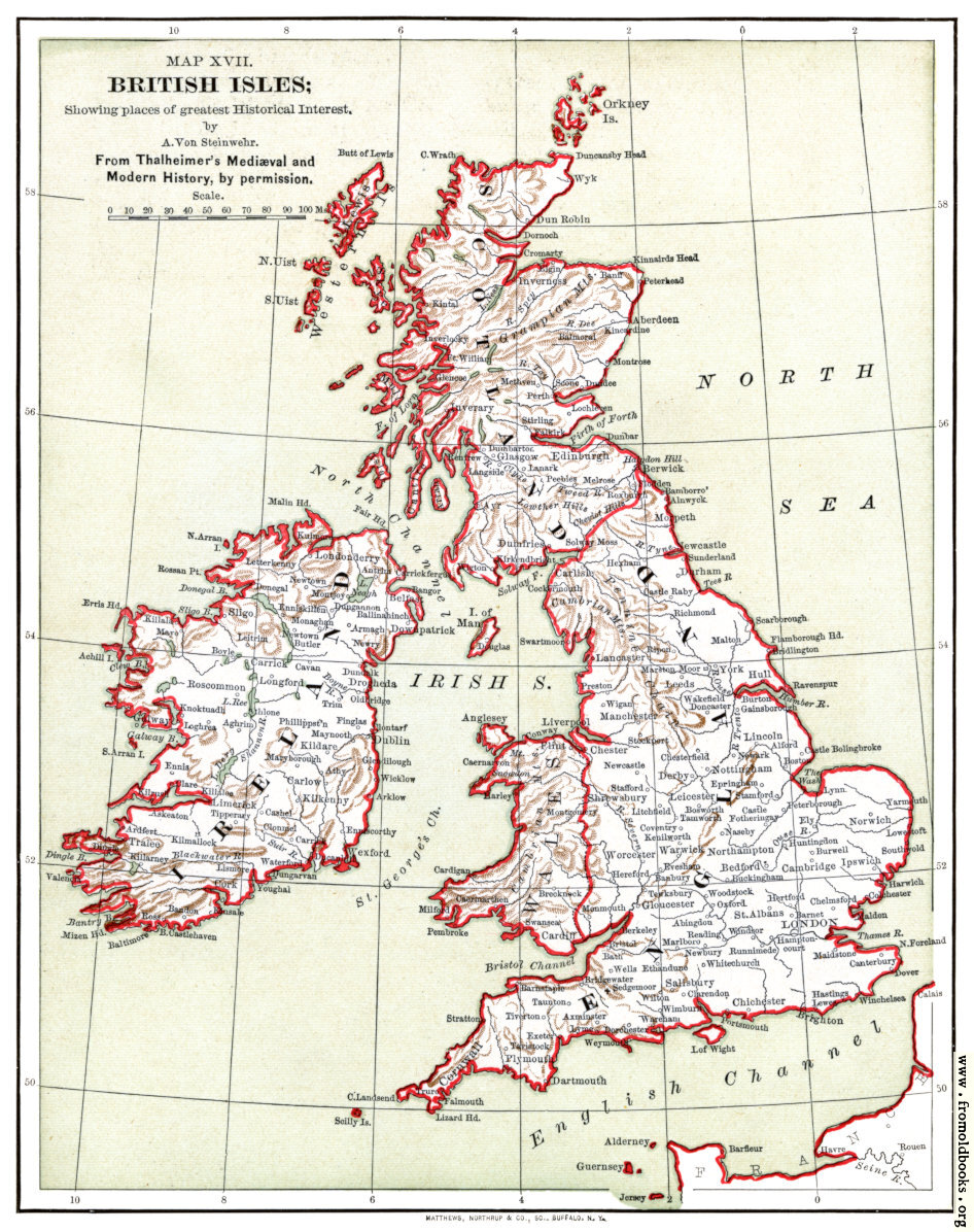
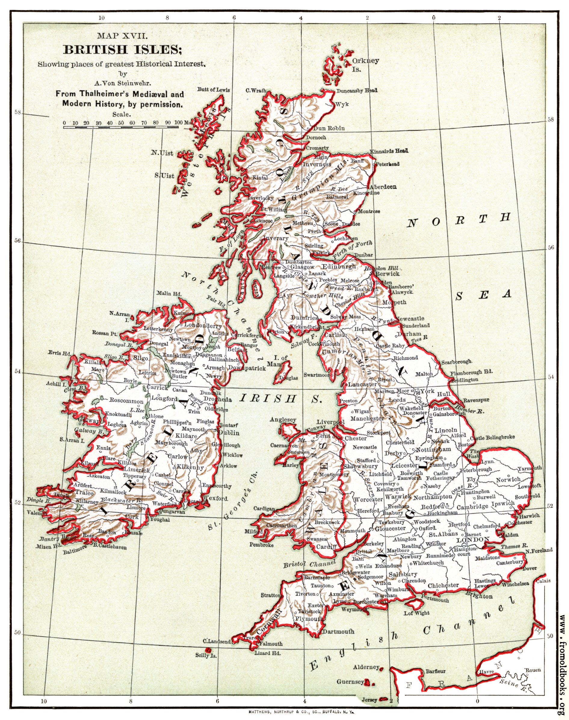
![[Picture: Map XVII. british Isles; Showing places of greatest Historical Interest.]](https://www.fromoldbooks.org/Ridpath-HistoryOfTheWorld-VolIII/pages/374-map-of-british-isles/../../tn/374-map-of-british-isles-q75-395x500.jpg "[Picture: Map XVII. british Isles; Showing places of greatest Historical Interest.]")
Download
Buy print-size file for commercial or other use
| 395x500 | 48K | jpg free download |
| 119x151 | 5K | jpg free download |
| 158x200 | 8K | jpg free download |
| 553x700 | 90K | jpg free download |
| 946x1196 | 367K | jpg free download |
| 1891x2392 | 1M | jpg free download |
About
Map XVII. british Isles; Showing places of greatest Historical Interest., in British Isles more