This site may be going away; please consider the Donate link above... or LiberaPay:

A huge thank you to all who donate; 2026 Q3 Web hosting $52.02 / $300.
This site may be going away; please consider the Donate link above... or LiberaPay:
A huge thank you to all who donate; 2026 Q3 Web hosting $52.02 / $300.
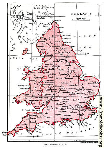
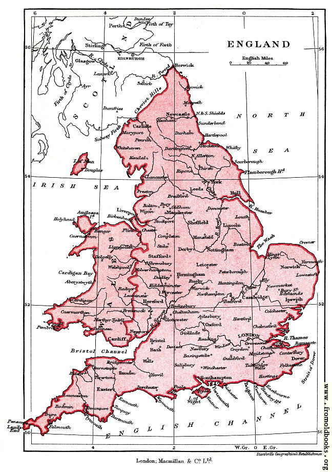
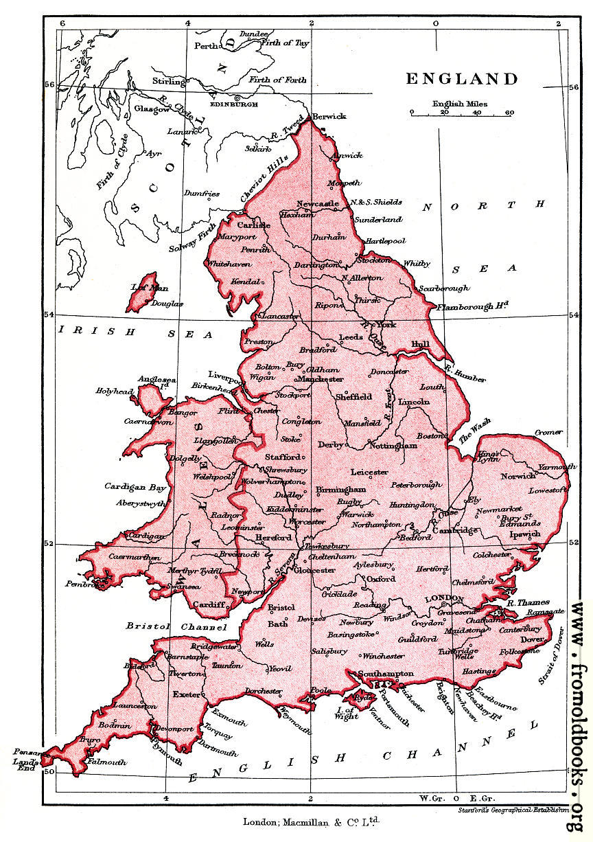
![[Picture: Frontispiece: Map of England]](https://www.fromoldbooks.org/Green-ShortHistory/pages/000-Frontispiece-map/000-Frontispiece-map-q75-648x919.jpg "[Picture: Frontispiece: Map of England]")
Buy print-size file for commercial or other use
This 1902 map shows an England of over 100 years ago. It is attributed to Stanford’s Geographical Establishment.