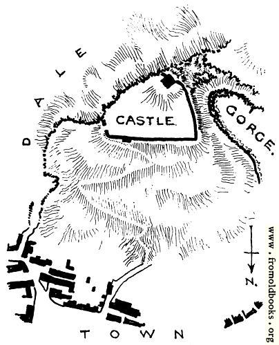
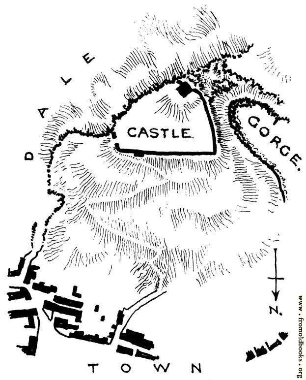
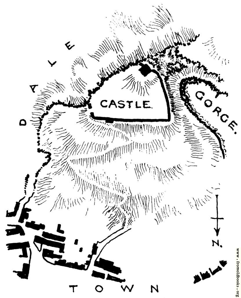
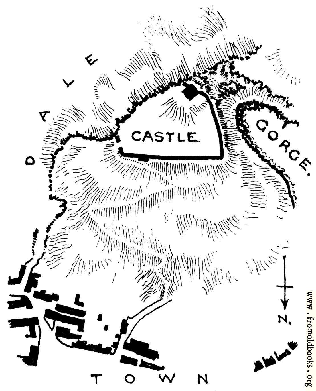
“It is tolerably certain that romance had no part in the selection of this site for a dwelling, but rather the assurance of security which it offered. An extremly steep spur of the rocky hill which forms one side of a precipitous dale—one of the dales for which Derbyshire is famous—is deeply bitten into by a gorge which almost severs it from its parent ridge (Fig. 7). An irregular triangle of rocky ground is thus formed rising steeply from its longest side up to the opposite angle, and bounded on one side by the precipitous slope of the dale, and on the other by the sheer descent of the gorge. No site could be better protected by nature. The side next [to] the gorge is absolutely inaccessible. The side next [to] the dale offers interesting hazards to good climbers. The remaining side is a grass slope steeper than most modern roofs, and traversed by a zigzag path up which the breathless visitor toils painfully. The town lies at the foot of the slope; the castle, of no great extent, is placed at its summit.” (p , 14)
![[Picture: Peak Castle, Derbyshire: Plan of the Site.]](https://www.fromoldbooks.org/Gotch/pages/007-Peak-Castle,Derbyshire/007-Peak-Castle,Derbyshire-q75-404x500.jpg "[Picture: Peak Castle, Derbyshire: Plan of the Site.]")