This site may be going away; please consider the Donate link above... or LiberaPay:

A huge thank you to all who donate; 2026 Q3 Web hosting $52.02 / $300.
This site may be going away; please consider the Donate link above... or LiberaPay:
A huge thank you to all who donate; 2026 Q3 Web hosting $52.02 / $300.
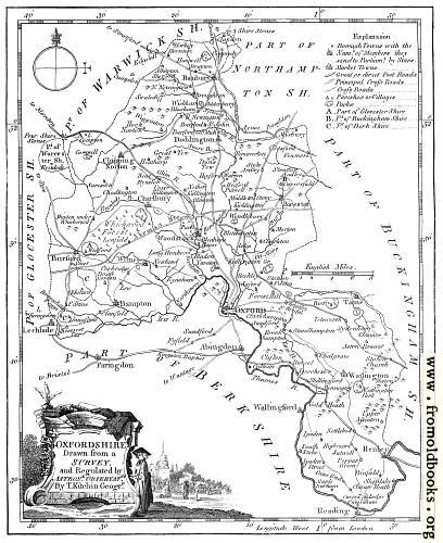
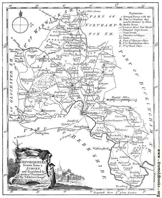
![[Picture: Antique Eighteenth-Century Map of Oxfordshire]](https://www.fromoldbooks.org/Boswell-Antiquities/pages/Oxfordshire-Map/Oxfordshire-Map-q75-566x694.jpg "[Picture: Antique Eighteenth-Century Map of Oxfordshire]")
Buy print-size file for commercial or other use
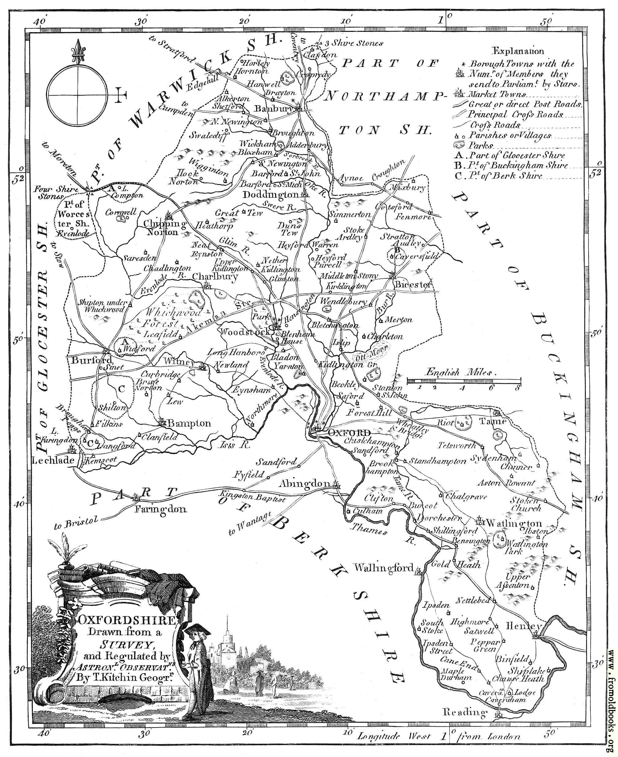
The map of Oxfordshire from Boswell’s 1786 Antiquities.
OXFORDSHIRE
Drawn from a
SURVEY
and Regulated by
Astronl. Observatns.
By T. Kitchen Geogrr.