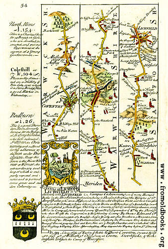
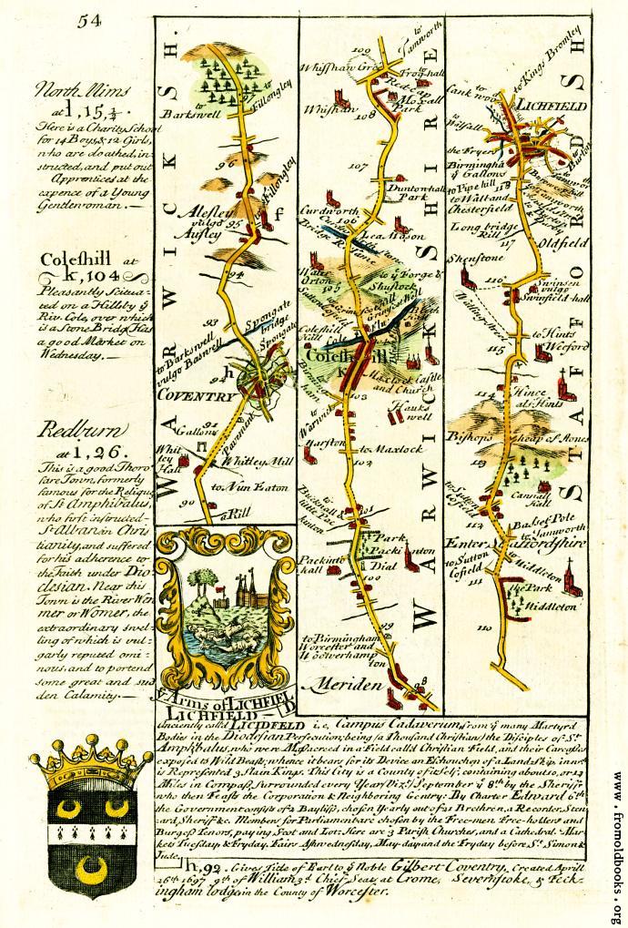
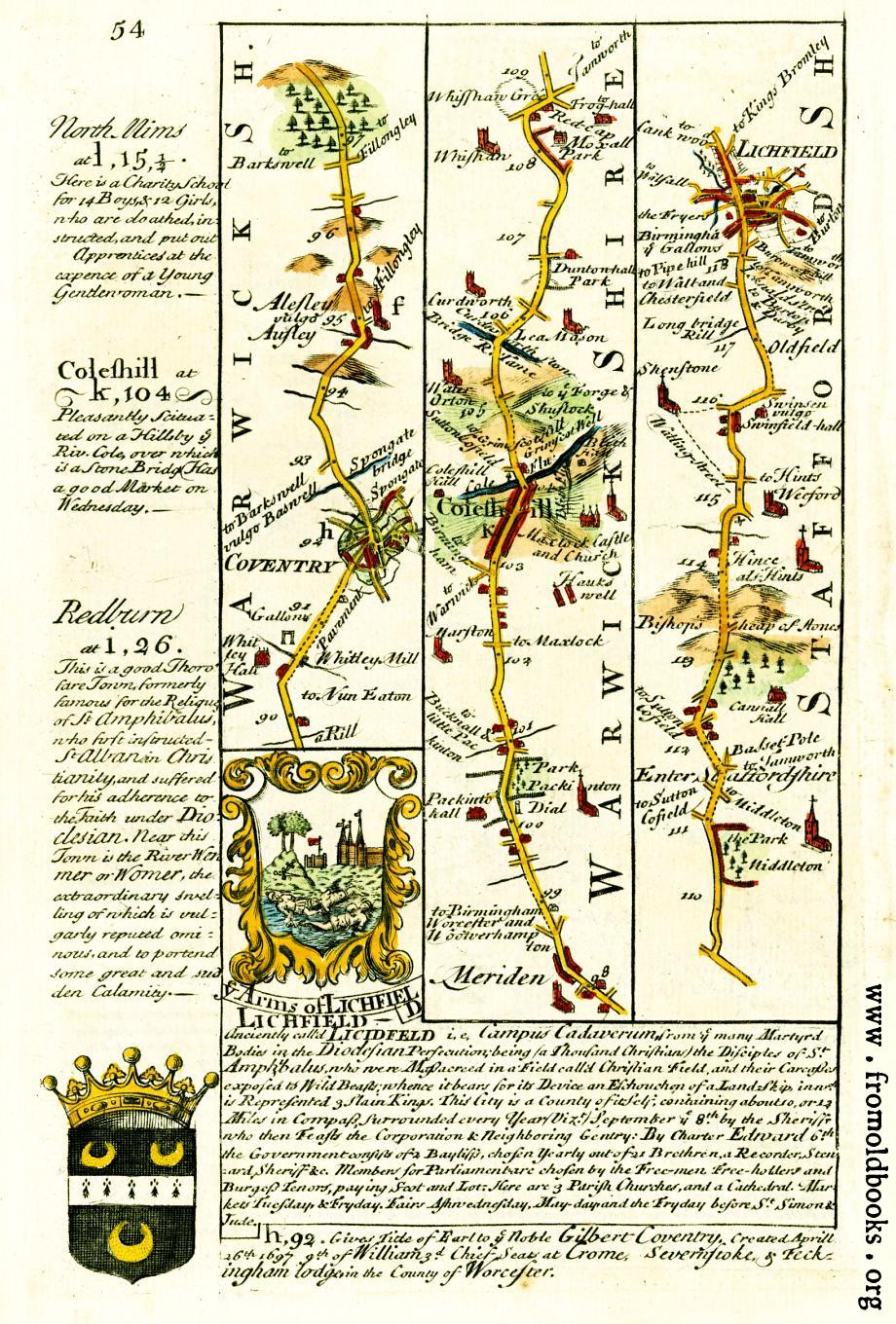
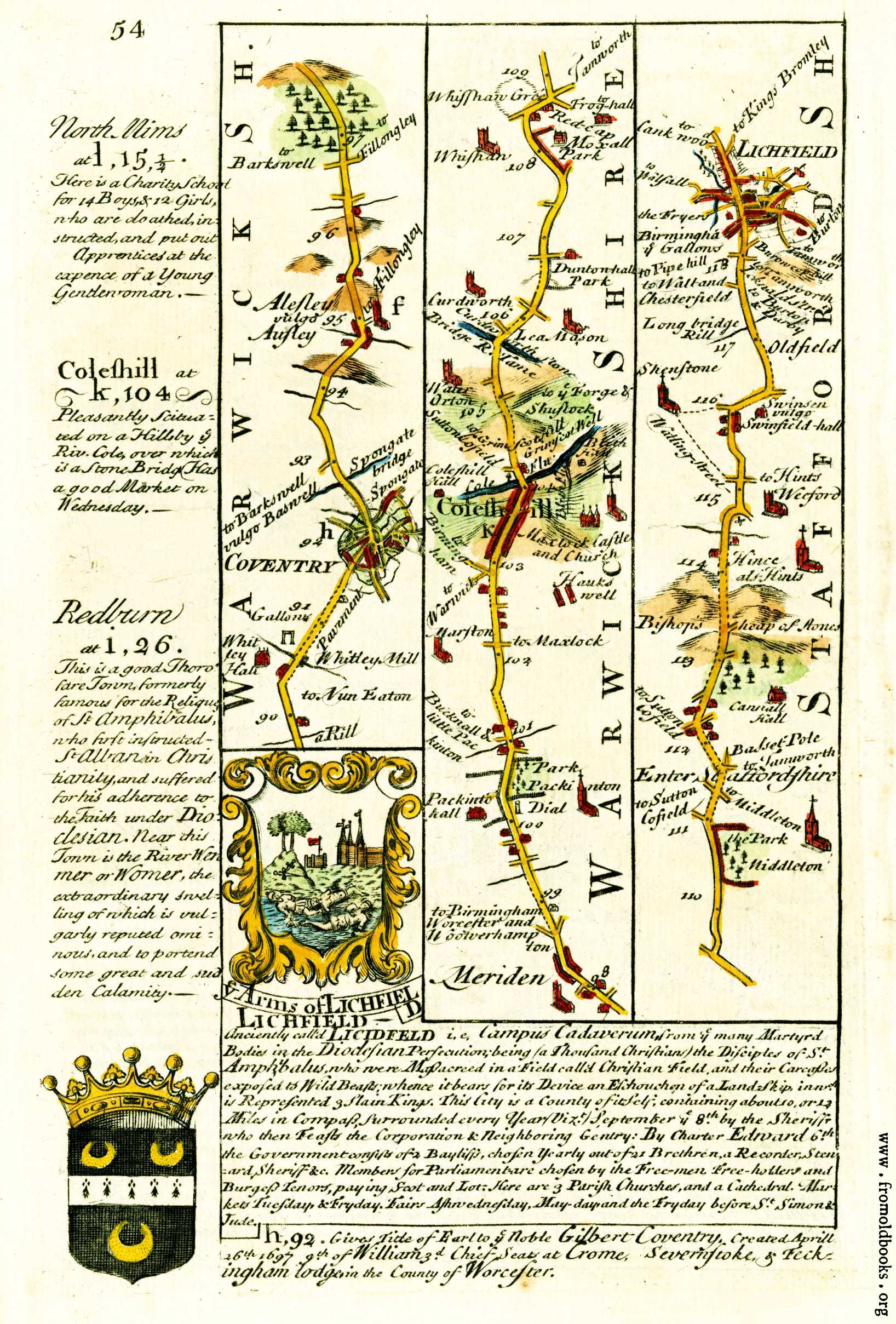
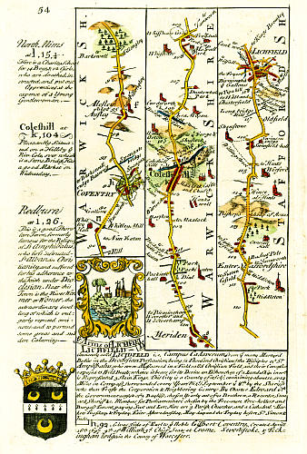
![[Picture: 54.—Coventry, Coleshill, Lichfield]](https://www.fromoldbooks.org/Bowen-BritanniaDepicta/pages/054-Litchfield/054-Litchfield-q75-1227x1813.jpg "[Picture: 54.—Coventry, Coleshill, Lichfield]")
Download
Buy print-size file for commercial or other use
Buy print-size file for commercial or other use
This is a route-map for people traveling in Great Britain; an early travel guide from 1720.
I have also scanned the other side of this page.
Get unwatermarked version
Buy print-size file for commercial or other use