This site may be going away; please consider the Donate link above... or LiberaPay:

A huge thank you to all who donate; 2026 Q3 Web hosting $52.02 / $300.
This site may be going away; please consider the Donate link above... or LiberaPay:
A huge thank you to all who donate; 2026 Q3 Web hosting $52.02 / $300.
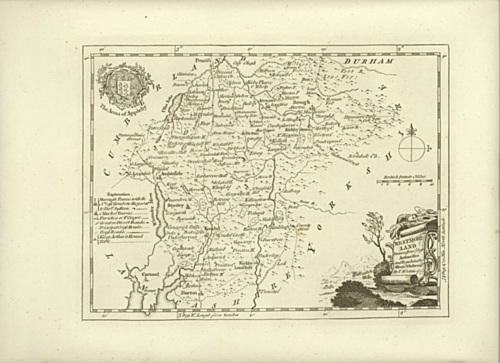
![[Picture: Antique Map of Westmoreland [Westmorland]]](https://www.fromoldbooks.org/Boswell-Antiquities/pages/Unedited-Westmoreland-Map/Unedited-Westmoreland-Map-3510x2551.jpg "[Picture: Antique Map of Westmoreland [Westmorland]]")
Buy print-size file for commercial or other use
| 500x363 | 71K | jpg free download |
| 120x87 | 5K | jpg free download |
| 275x200 | 23K | jpg free download |
| 1024x744 | 309K | jpg free download |
| 1600x1163 | 760K | jpg free download |
| 3510x2551 | 2M | jpg free download |
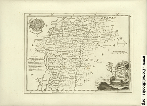
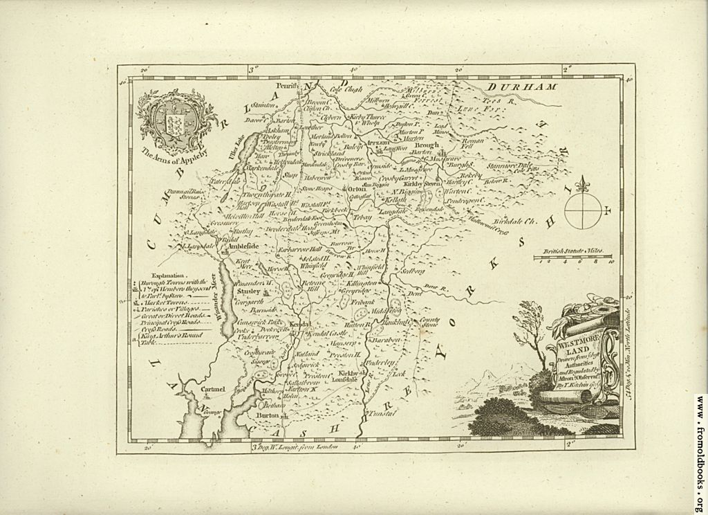
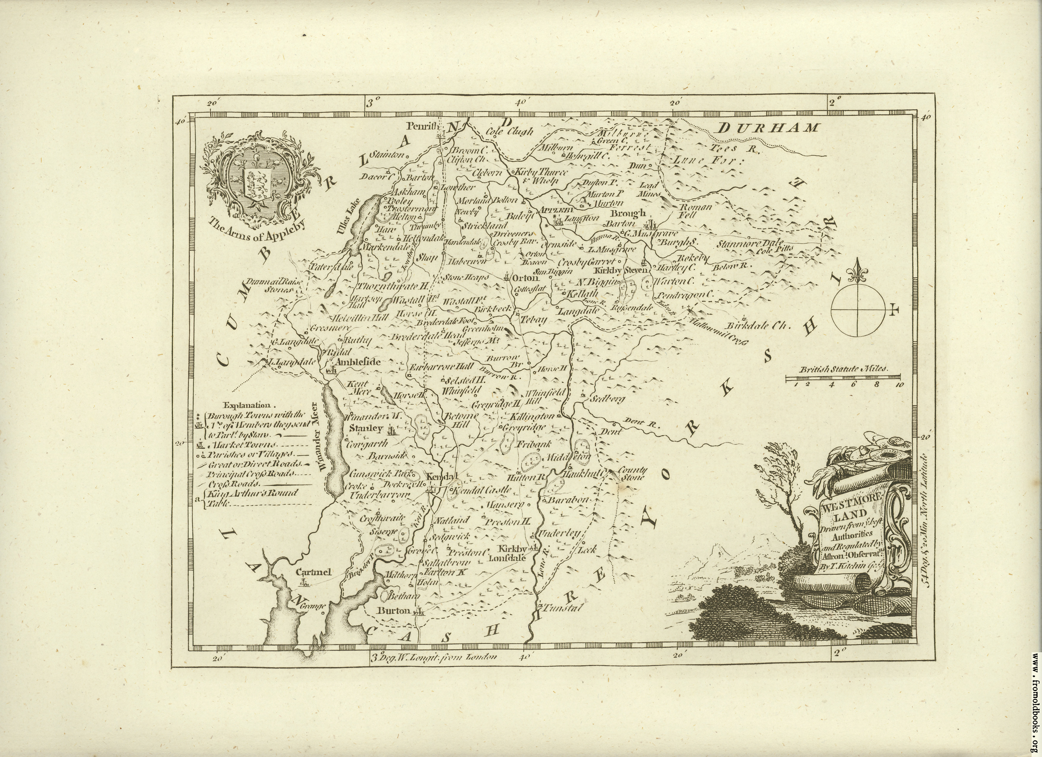
Antique Map of Westmoreland (more recently written as “Westmorland” instead).