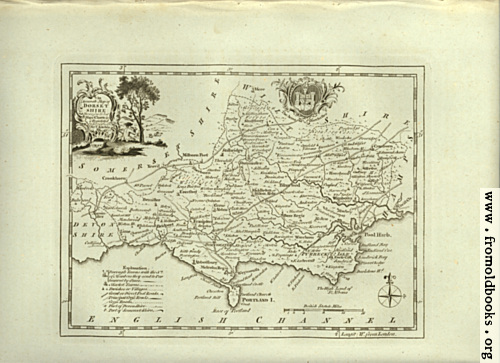
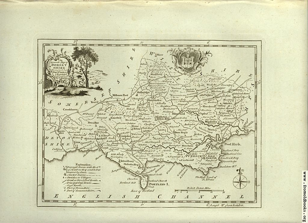
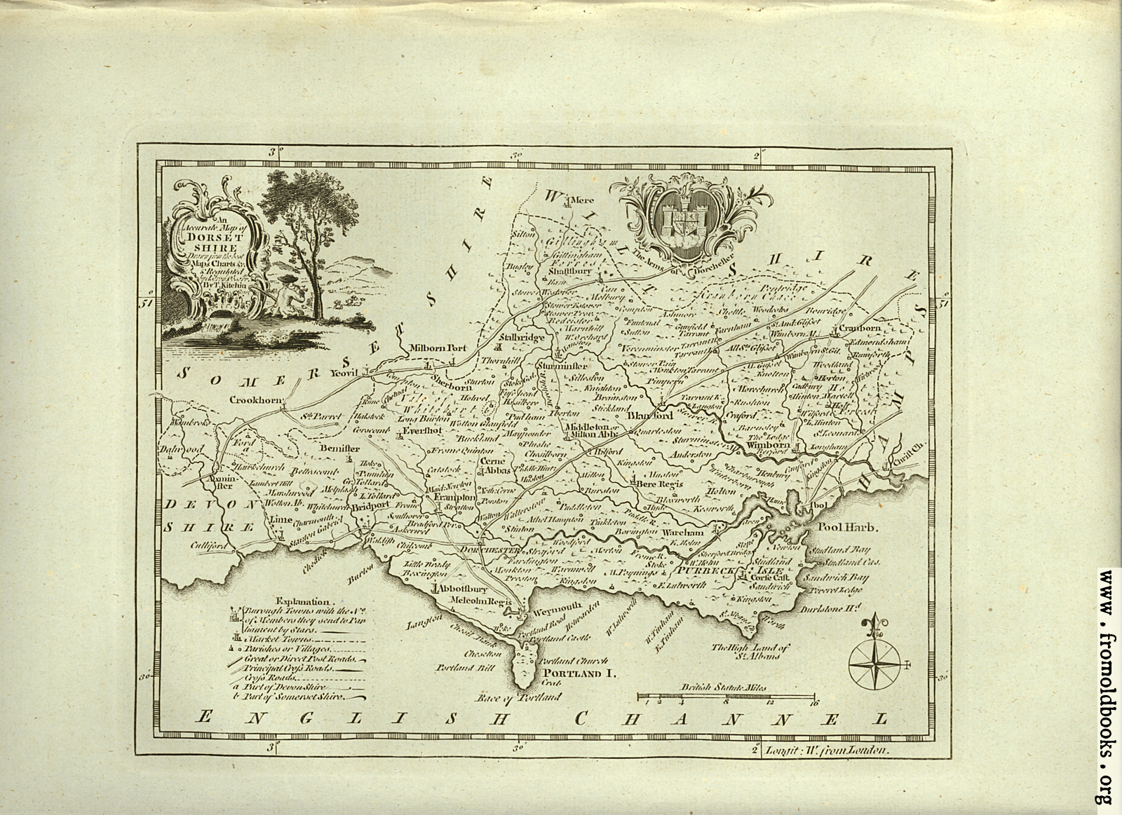
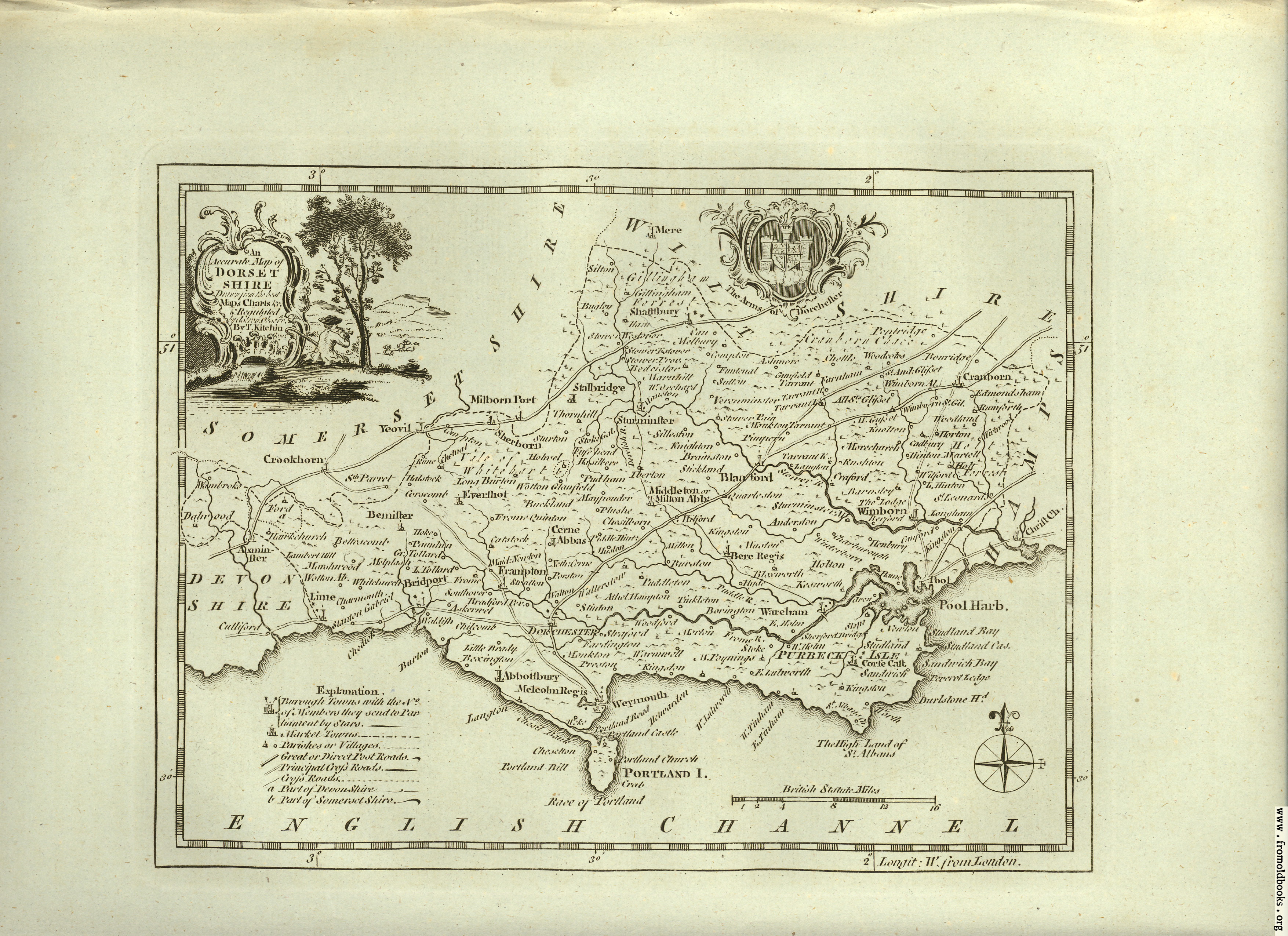
![[Picture: Antique Map of Dorsetshire]](https://www.fromoldbooks.org/Boswell-Antiquities/pages/Unedited-Dorsetshire-Map/Unedited-Dorsetshire-Map-1024x744.jpg "[Picture: Antique Map of Dorsetshire]")
Download
Buy print-size file for commercial or other use
| 500x363 | 84K | jpg free download |
| 120x87 | 5K | jpg free download |
| 275x200 | 26K | jpg free download |
| 1024x744 | 364K | jpg free download |
| 1600x1163 | 906K | jpg free download |
| 3510x2551 | 2M | jpg free download |
Buy print-size file for commercial or other use
| 500x363 | 84K | jpg free download |
| 120x87 | 5K | jpg free download |
| 275x200 | 26K | jpg free download |
| 1024x744 | 364K | jpg free download |
| 1600x1163 | 906K | jpg free download |
| 3510x2551 | 2M | jpg free download |
Antique Map of Dorsetshire