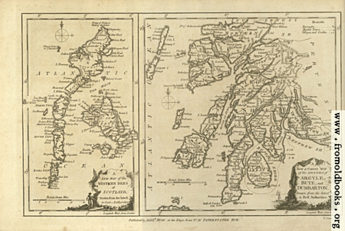
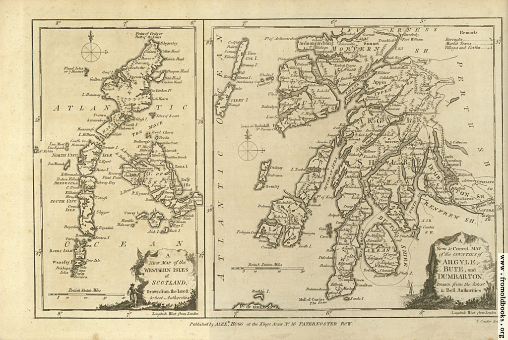
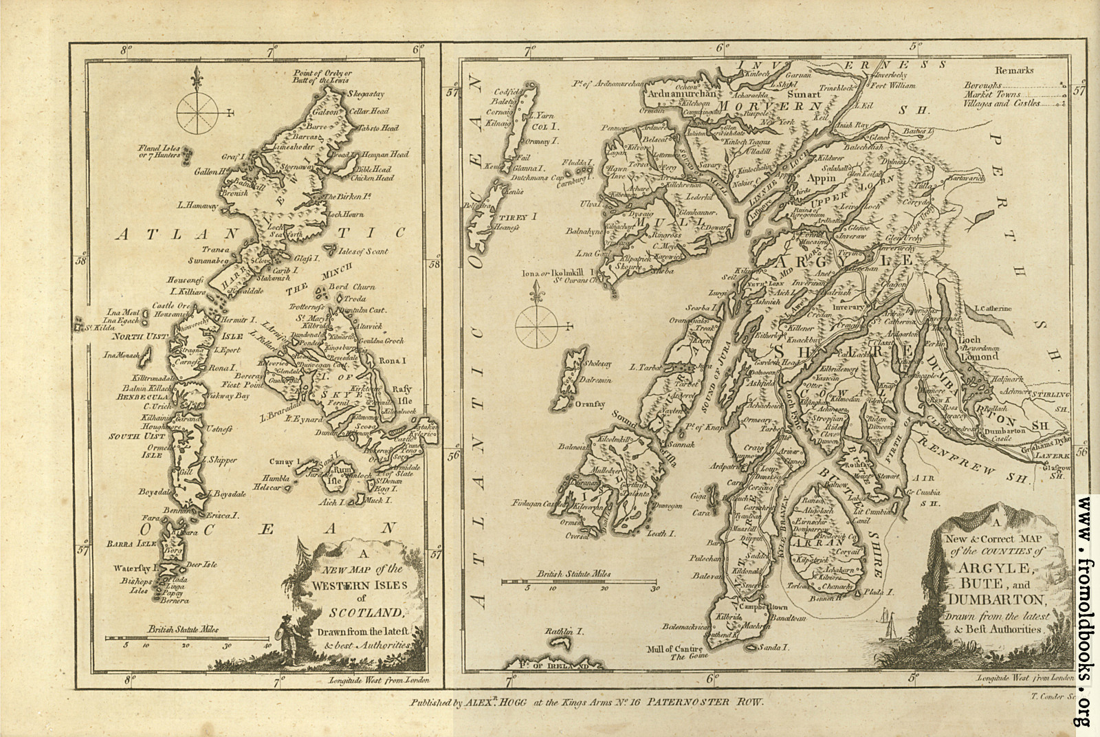
![[Picture: Antique Map of Argyle, Bute and Dumbarton, in Scotland]](https://www.fromoldbooks.org/Boswell-Antiquities/pages/Unedited-Argyle-Bute-Dumbarton-Scotland-Map/Unedited-Argyle-Bute-Dumbarton-Scotland-Map-500x335.jpg "[Picture: Antique Map of Argyle, Bute and Dumbarton, in Scotland]")
Download
Buy print-size file for commercial or other use
| 500x335 | 71K | jpg free download |
| 119x80 | 5K | jpg free download |
| 299x200 | 28K | jpg free download |
| 1024x686 | 294K | jpg free download |
| 1600x1072 | 732K | jpg free download |
| 4254x2849 | 2M | jpg free download |
This site is in danger of going away; please consider the Donate link above...
Buy print-size file for commercial or other use
| 500x335 | 71K | jpg free download |
| 119x80 | 5K | jpg free download |
| 299x200 | 28K | jpg free download |
| 1024x686 | 294K | jpg free download |
| 1600x1072 | 732K | jpg free download |
| 4254x2849 | 2M | jpg free download |
Antique Map of Argyle, Bute and Dumbarton, in Scotland