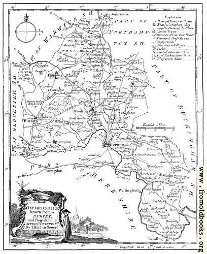
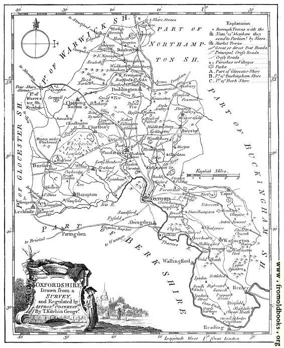
![[Picture: Antique Eighteenth-Century Map of Oxfordshire]](https://www.fromoldbooks.org/Boswell-Antiquities/pages/Oxfordshire-Map/Oxfordshire-Map-q85-1008x1235.jpg "[Picture: Antique Eighteenth-Century Map of Oxfordshire]")
Download
Buy print-size file for commercial or other use
Buy print-size file for commercial or other use
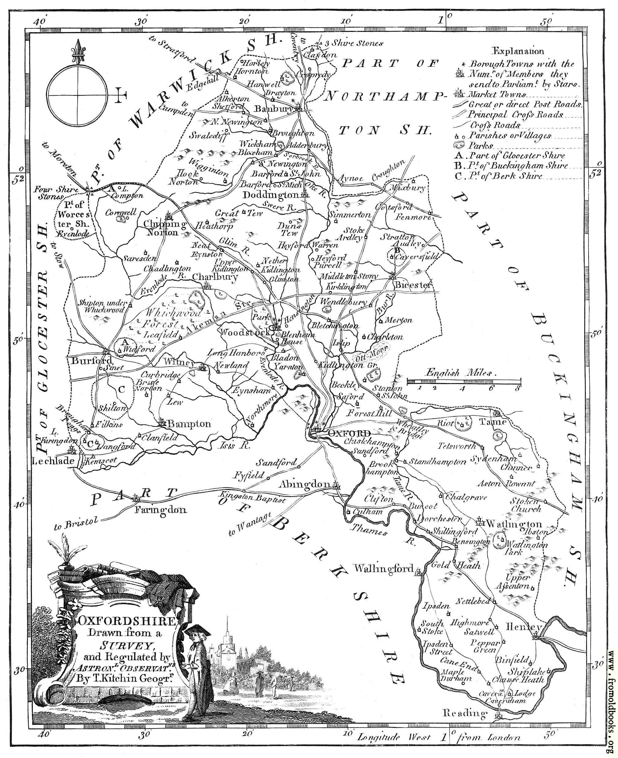
The map of Oxfordshire from Boswell’s 1786 Antiquities.
OXFORDSHIRE
Drawn from a
SURVEY
and Regulated by
Astronl. Observatns.
By T. Kitchen Geogrr.