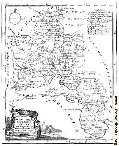
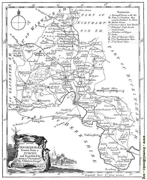
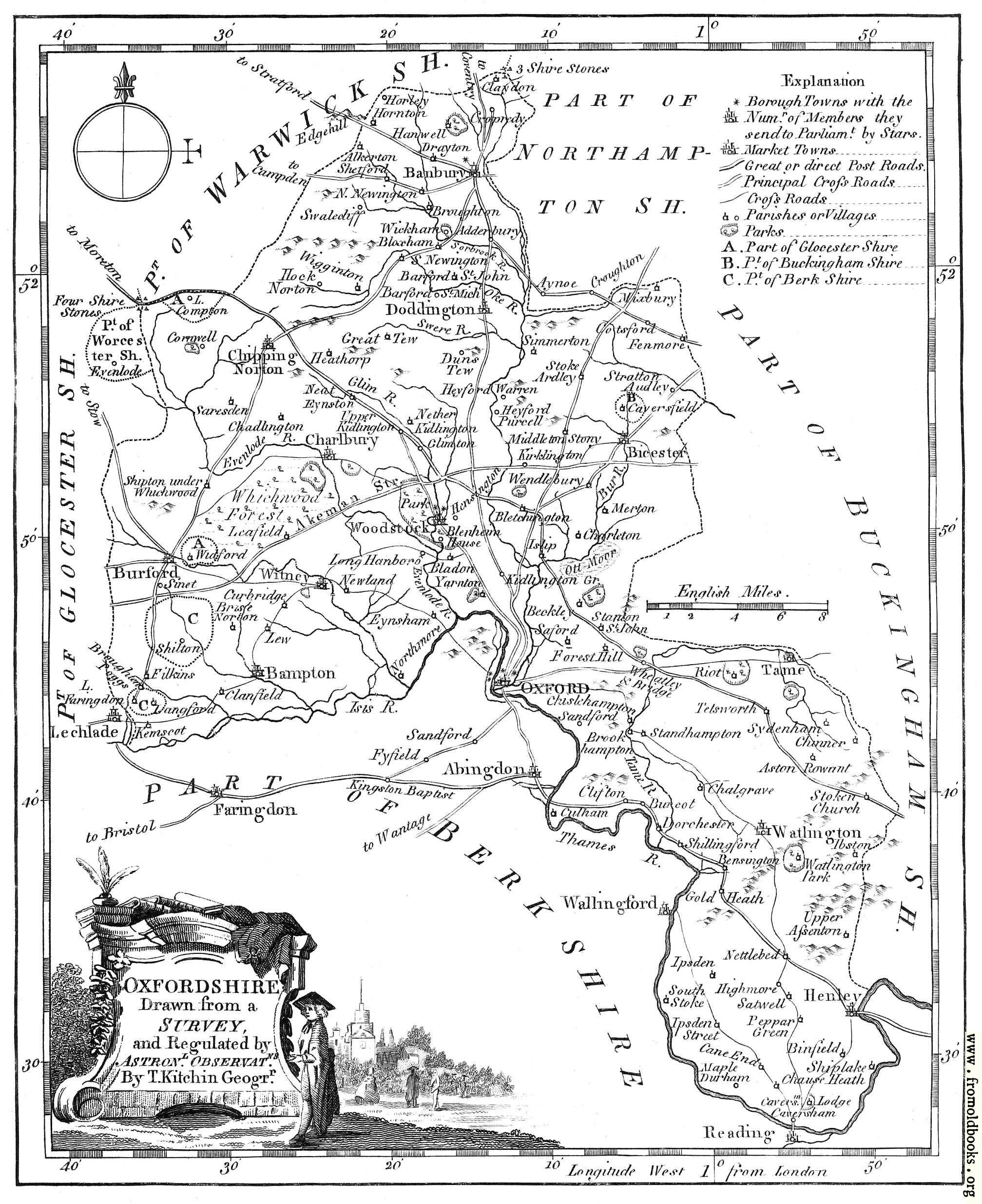
![[Picture: Antique Eighteenth-Century Map of Oxfordshire]](https://www.fromoldbooks.org/Boswell-Antiquities/pages/Oxfordshire-Map/Oxfordshire-Map-q75-408x500.jpg "[Picture: Antique Eighteenth-Century Map of Oxfordshire]")
Download
Buy print-size file for commercial or other use
| 408x500 | 59K | jpg free download |
| 120x147 | 6K | jpg free download |
| 163x200 | 8K | jpg free download |
| 566x694 | 108K | jpg free download |
| 756x926 | 215K | jpg free download |
| 1008x1235 | 350K | jpg free download |
| 2015x2469 | 612K | jpg free download |