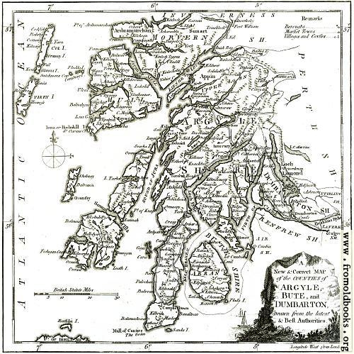
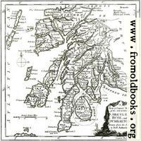
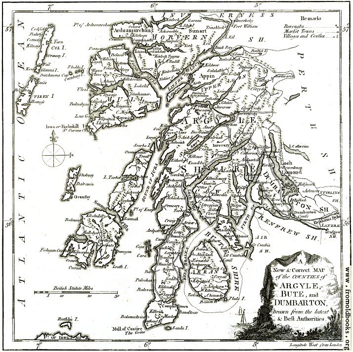
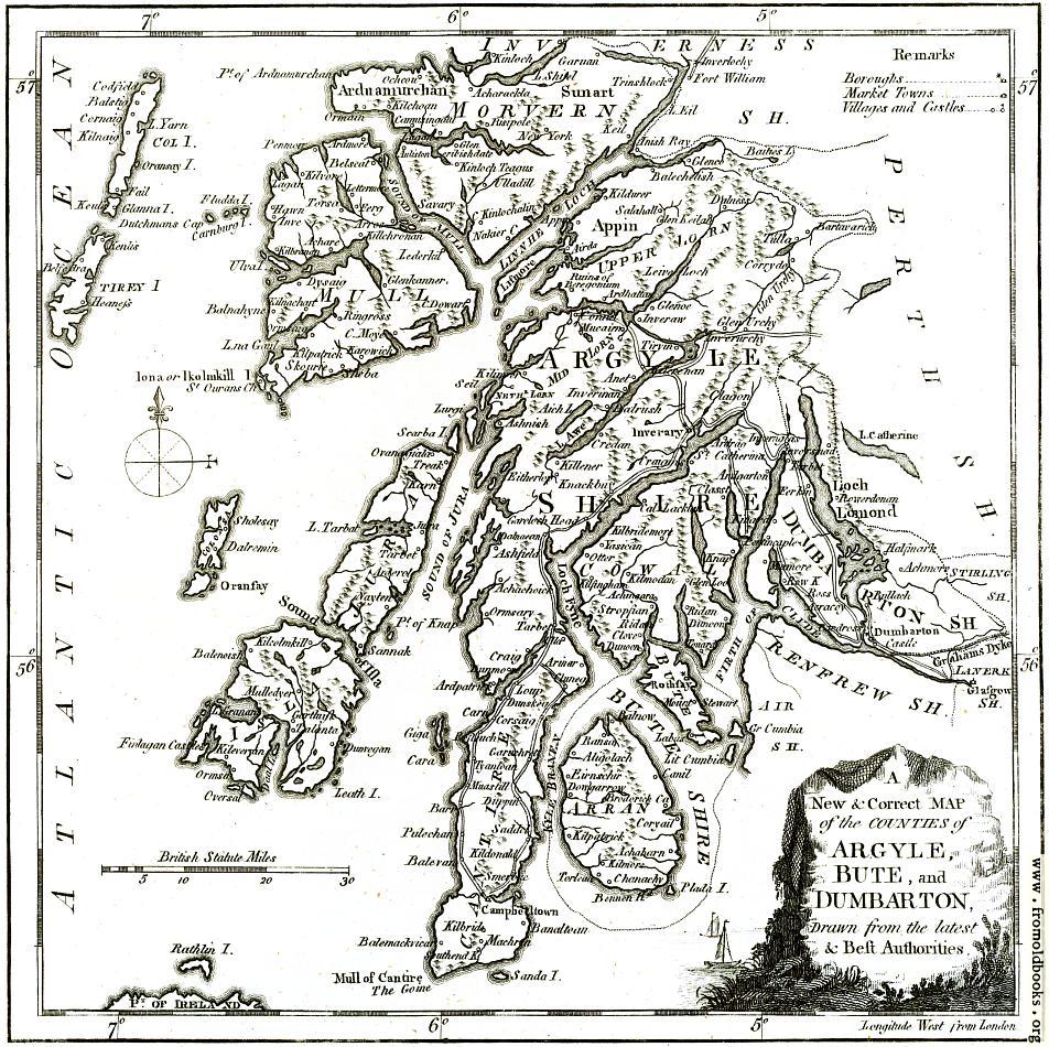
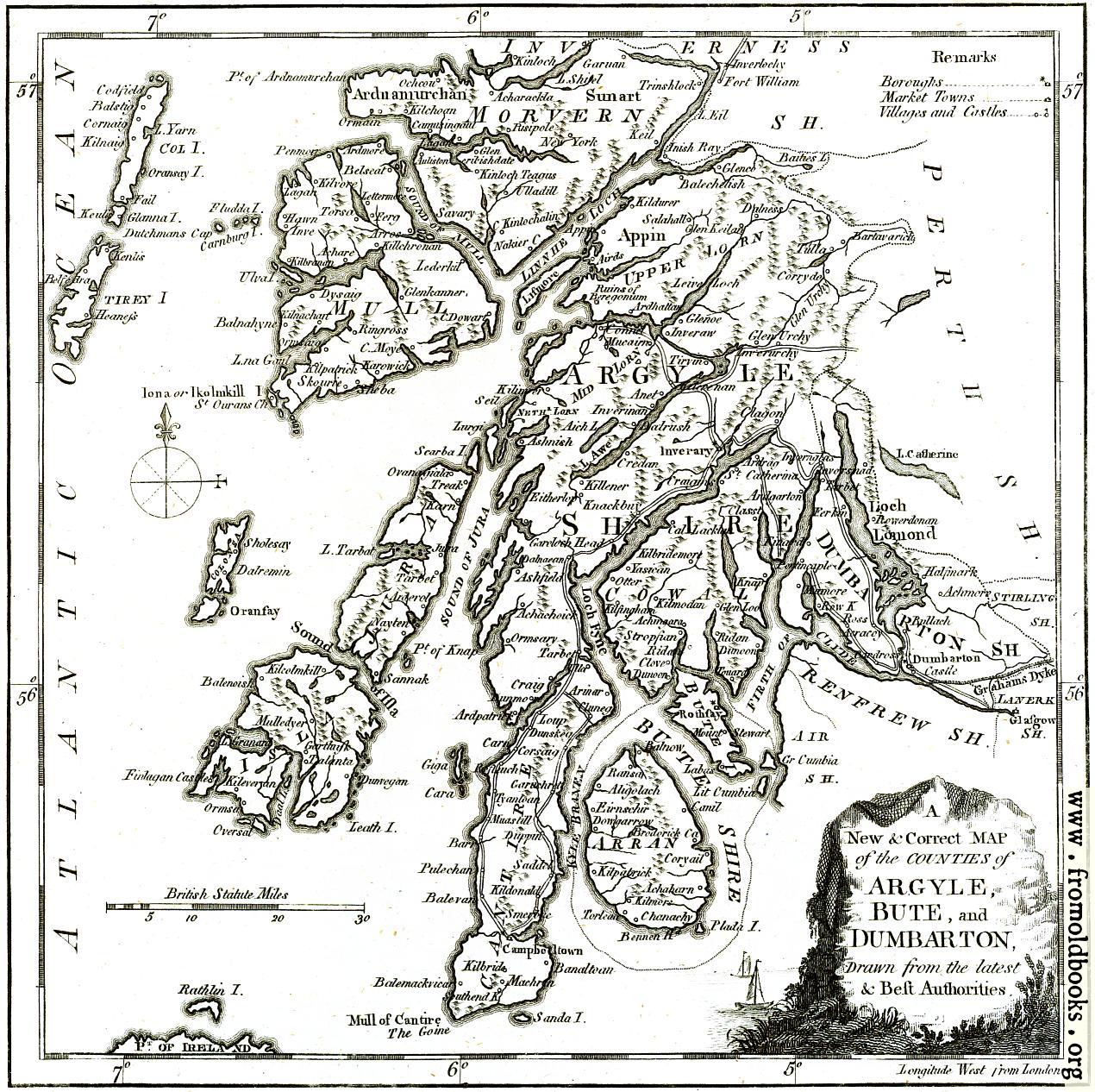
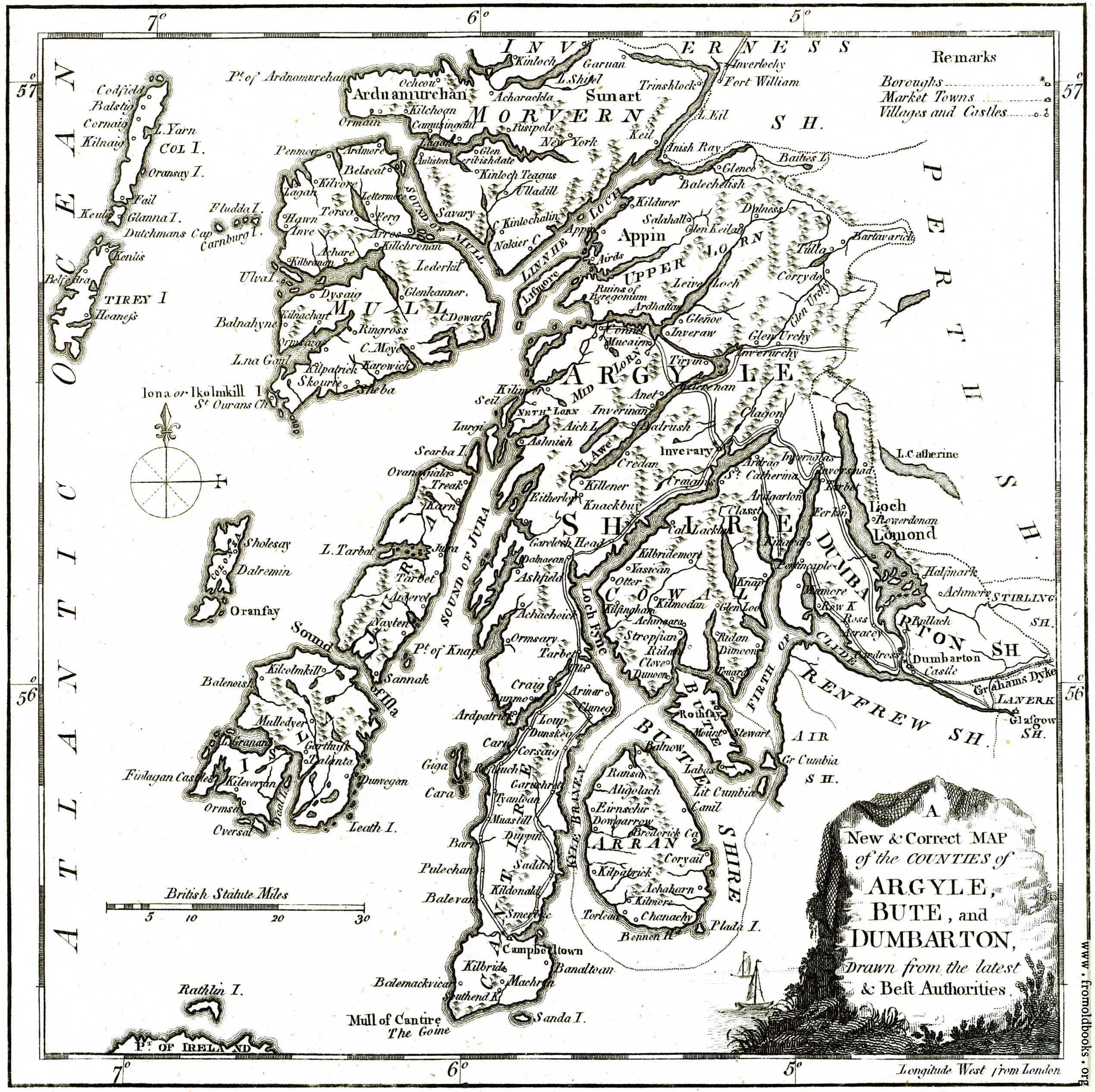
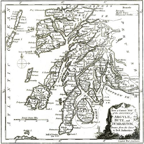
![[Picture: A New & Correct MAP of the Counties of Argyle, Bute and Dumbarton]](https://www.fromoldbooks.org/Boswell-Antiquities/pages/Argyle-detail-Map/../../tn/Argyle-detail-Map-q75-500x499.jpg "[Picture: A New & Correct MAP of the Counties of Argyle, Bute and Dumbarton]")
Download
Buy print-size file for commercial or other use
| 500x499 | 82K | jpg free download |
| 119x119 | 6K | jpg free download |
| 200x200 | 13K | jpg free download |
| 714x712 | 191K | jpg free download |
| 952x950 | 257K | jpg free download |
| 1270x1266 | 415K | jpg free download |
| 2539x2532 | 809K | jpg free download |