This site may be going away; please consider the Donate link above... or LiberaPay:

A huge thank you to all who donate; 2026 Q3 Web hosting $52.02 / $300.
This site may be going away; please consider the Donate link above... or LiberaPay:
A huge thank you to all who donate; 2026 Q3 Web hosting $52.02 / $300.
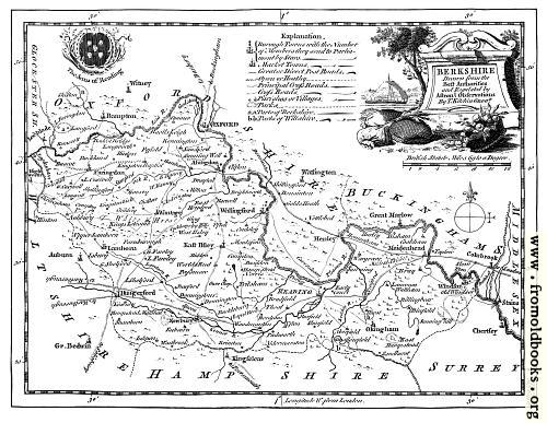
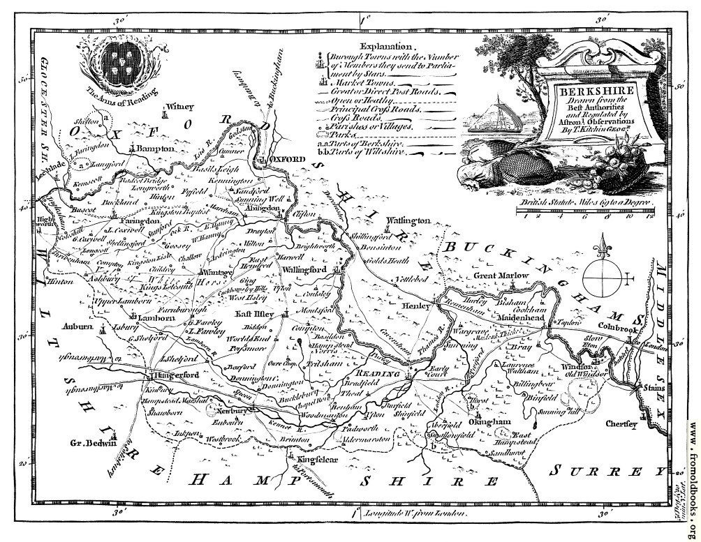
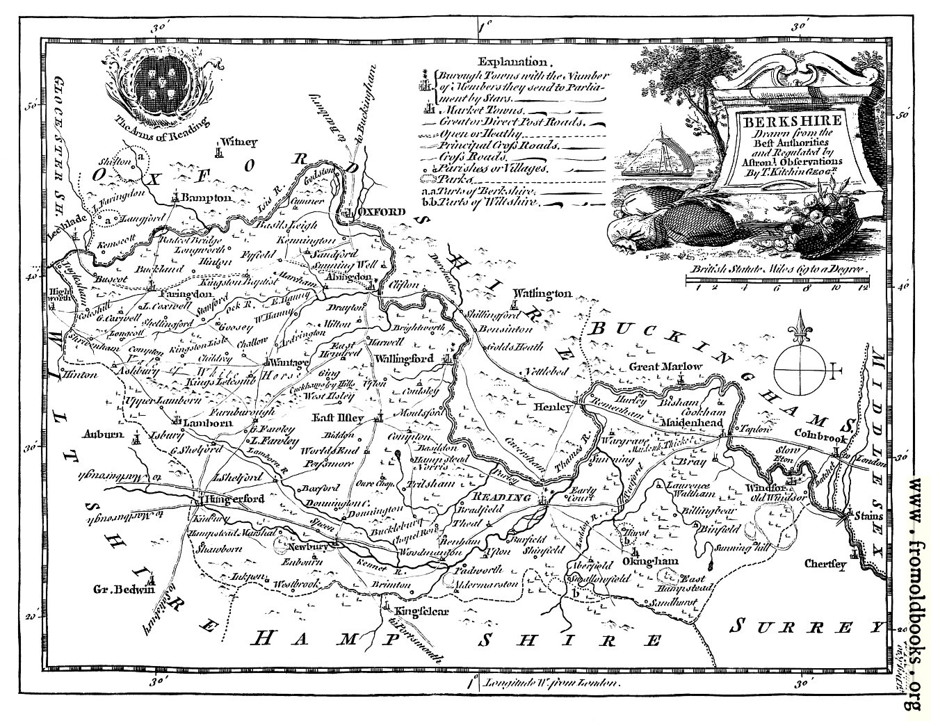
![[Picture: Antique Eighteenth-Century Map of Berkshire]](https://www.fromoldbooks.org/Boswell-Antiquities/pages/Berkshire-Map/Berkshire-Map-q90-1004x777.jpg "[Picture: Antique Eighteenth-Century Map of Berkshire]")
Buy print-size file for commercial or other use
BERKSHIRE
Drawn from the
Best Authorities
and Regulated by
Astronomical Observations
By T. Kitchin Geogr.
This 1786 (approx.) map includes Reading, Abingdon, Faringdon, Wantage, Wallingford, East Ilsley Lamborn, Hugerford, Newbury, Okingham, Windsor, Henley, Maidenhead and many more places.
Comments:
Added by d3vi on Sun May 31 10:08:37 2009
I think that it is useful for history