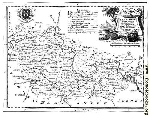
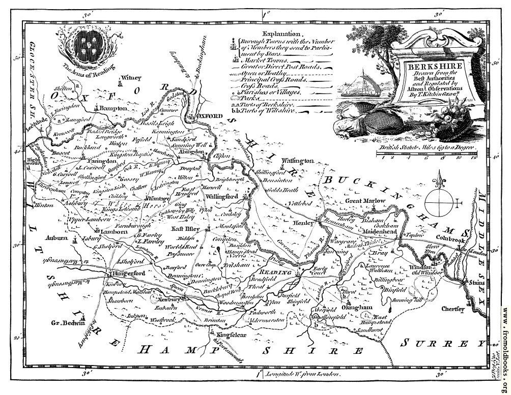
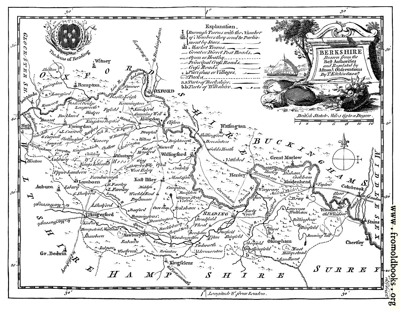
Antique Eighteenth-Century Map of Berkshiredetails

[Picture: Antique Eighteenth-Century Map of Berkshire]
previous image
up
624115_300x250 Hang out in an empty Sistine Chapel

Antique Eighteenth-Century Map of Berkshire, in Berkshire, England more

maps, greyscale

foreground: none
background: none

Image title: Antique Eighteenth-Century Map of Berkshire
Source: Boswell, Henry: “The Antiquities of England and Wales” (1786)
Place shown: Berkshire, England
Keywords: maps, greyscale
Status: out of copyright (called public domain in the USA), hence royalty-free stock image for all purposes usage credit requested
Please do not redistribute without permission, since running this site is expensive.
Share/Bookmark Arts Blogs - Blog Top Sites

BERKSHIRE
Drawn from the
Best Authorities
and Regulated by
Astronomical Observations
By T. Kitchin Geogr.

This 1786 (approx.) map includes Reading, Abingdon, Faringdon, Wantage, Wallingford, East Ilsley Lamborn, Hugerford, Newbury, Okingham, Windsor, Henley, Maidenhead and many more places.

Filename: Berkshire-Map-q75-500x387.jpg
Cartographer: T. Kitchin
Scanner dpi: 300
Unmarked: You can get a version of this image without the watermark at the lower right corner by requesting it in using the comment link below. The images are watermarked to help people find where they came from if they get reposted to blogs or other sites. Images under 1200 pixels on a side are still free, although I will ask for a donation :-)

Comments:

Added by d3vi on Sun May 31 10:08:37 2009

I think that it is useful for history

Comment: Add a link, leave a comment or change keywords

$Id: mkgallery,v 1.27 2012/09/03 22:34:40 liam Exp liam $

Valid XHTML 1.0! Valid CSS!