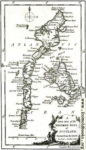
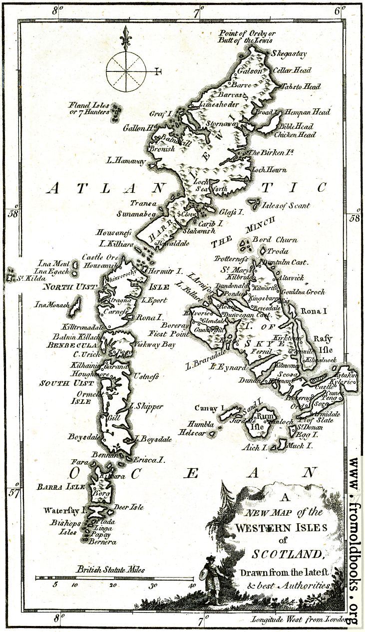
![[Picture: Antique Eighteenth-Century Map of the Western Islesof Scotland]](https://www.fromoldbooks.org/Boswell-Antiquities/pages/Argyle-detail-Western-Isles-Map/Argyle-detail-Western-Isles-Map-q75-289x500.jpg "[Picture: Antique Eighteenth-Century Map of the Western Islesof Scotland]")
Download
Buy print-size file for commercial or other use
| 289x500 | 44K | jpg free download |
| 116x200 | 8K | jpg free download |
| 120x207 | 9K | jpg free download |
| 548x950 | 169K | jpg free download |
| 731x1266 | 231K | jpg free download |
| 1461x2532 | 586K | jpg free download |
This site is in danger of going away; please consider the Donate link above...
Buy print-size file for commercial or other use
| 289x500 | 44K | jpg free download |
| 116x200 | 8K | jpg free download |
| 120x207 | 9K | jpg free download |
| 548x950 | 169K | jpg free download |
| 731x1266 | 231K | jpg free download |
| 1461x2532 | 586K | jpg free download |
A
NEW MAP of the
Western Isles
of
SCOTLAND,
Drawn from the latest
& best Authorities.
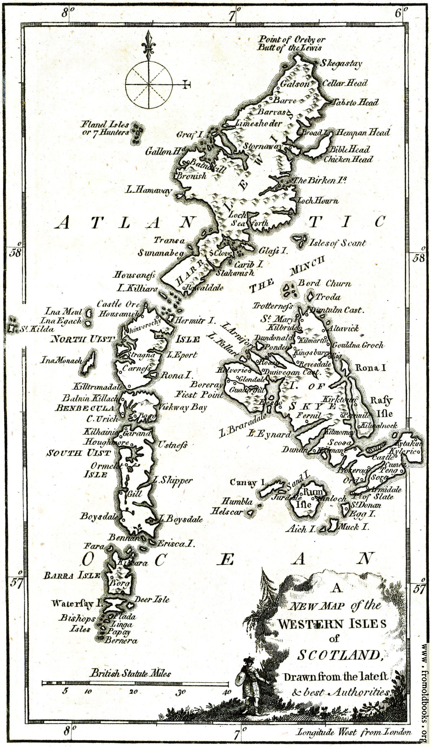
This antique map from 1786 shows the Isle of Skye with Keslo, Trotterness, Dunvegan and Pevuile visible, and also Harris, the isles of Uist and, to the North, the isle of Lewis.
The original map was probably a fold-out, and had two parts; this is the left-hand side, and there is also adjoining a Map of the Western Isles.