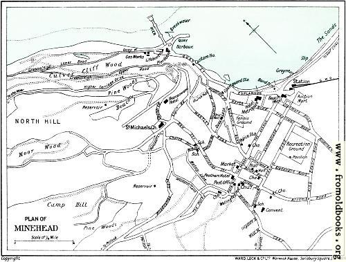
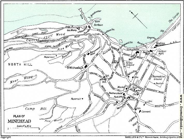
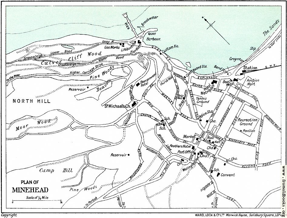
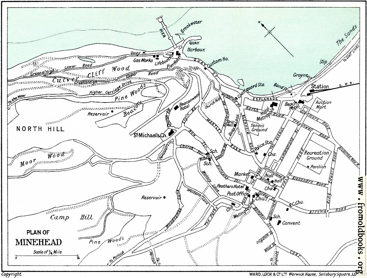
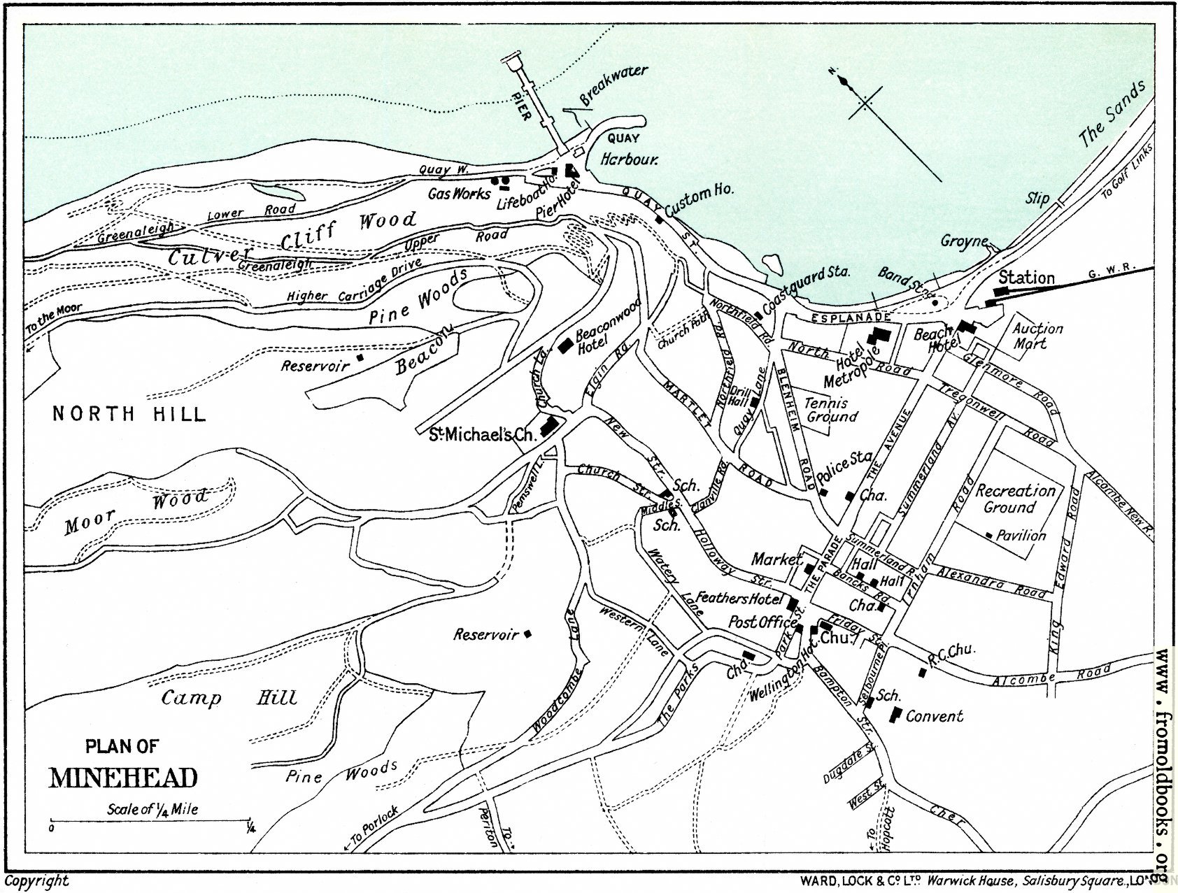
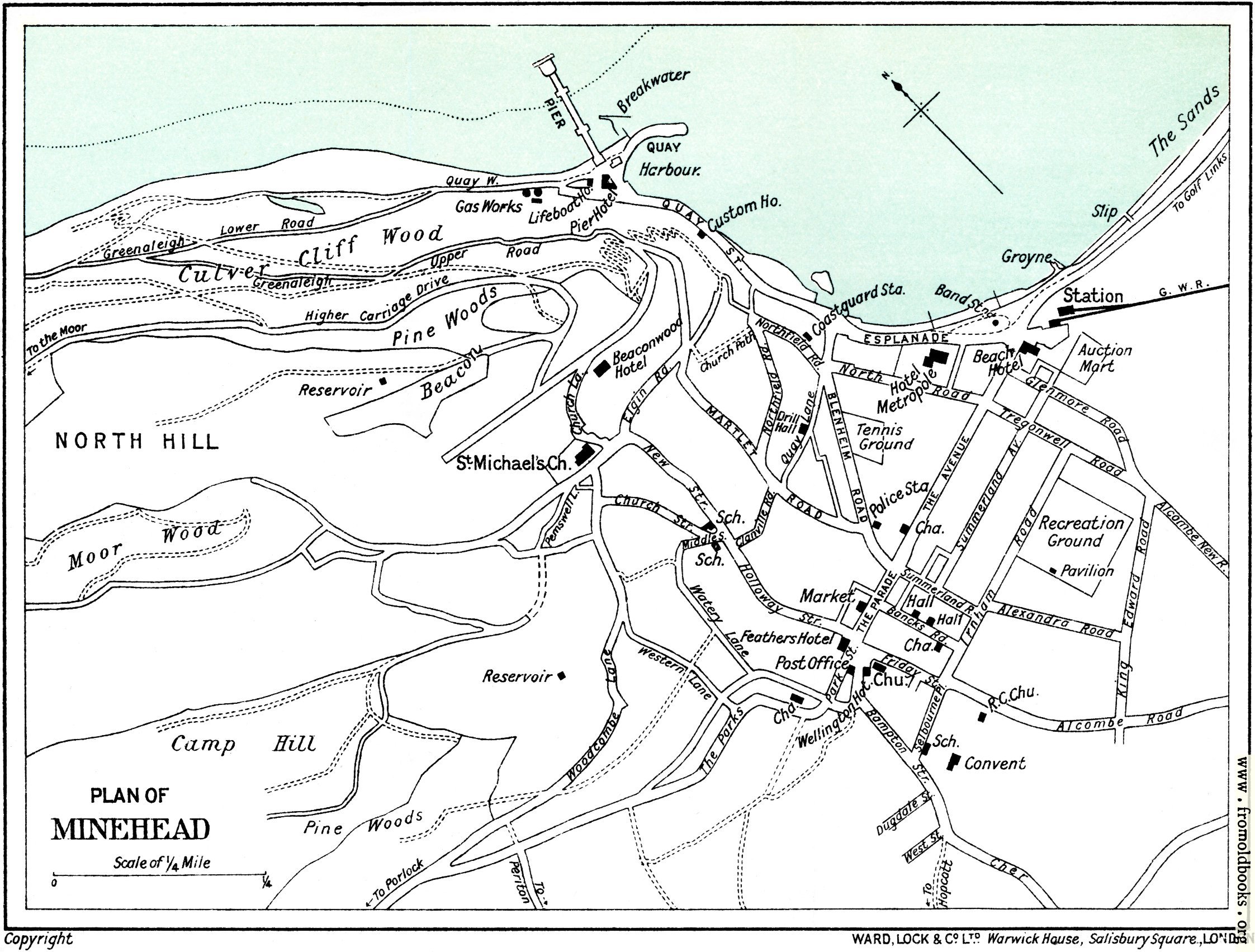
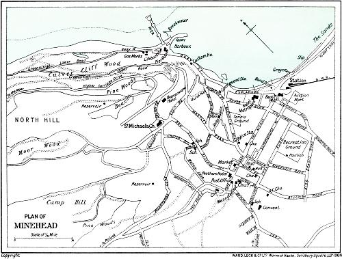
![[Picture: Plan of Minehead [1910]]](https://www.fromoldbooks.org/WardLockCo-LyntonAndMonmouth/pages/Minehead-01-Plan-of-Minehead/Minehead-01-Plan-of-Minehead-q75-500x379.jpg "[Picture: Plan of Minehead [1910]]")
Download
Buy print-size file for commercial or other use
| 500x379 | 51K | jpg free download |
| 119x90 | 4K | jpg free download |
| 264x200 | 14K | jpg free download |
| 710x539 | 104K | jpg free download |
| 947x718 | 197K | jpg free download |
| 1263x958 | 288K | jpg free download |
| 1684x1277 | 448K | jpg free download |
| 2245x1703 | 671K | jpg free download |