![[Picture: Buckinghamshire]](https://www.fromoldbooks.org/Grose-Antiquities/pages/Buckinghamshire/Buckinghamshire-q75-755x636.jpg "[Picture: Buckinghamshire]")
Download
Buy print-size file for commercial or other use
| 500x421 | 64K | jpg free download |
| 120x101 | 4K | jpg free download |
| 238x200 | 15K | jpg free download |
| 755x636 | 116K | jpg free download |
| 1007x848 | 214K | jpg free download |
| 1343x1130 | 331K | jpg free download |
Buy print-size file for commercial or other use
| 500x421 | 64K | jpg free download |
| 120x101 | 4K | jpg free download |
| 238x200 | 15K | jpg free download |
| 755x636 | 116K | jpg free download |
| 1007x848 | 214K | jpg free download |
| 1343x1130 | 331K | jpg free download |
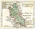
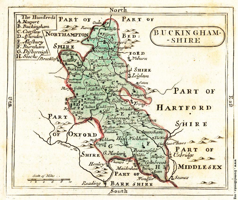
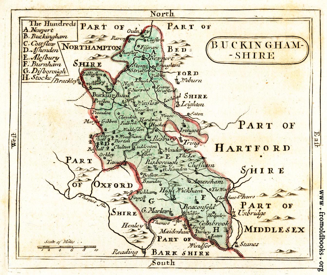
A public domain map of the County of Buckinghamshire in England, from 1783.
Places marked on the map include the following: The Hundreds: A. Newport; B. Buckingham; C. Cottslow; D. Ashenden; E. Alesbury; F. Burnham; G. Disborough; H. Stocke.
Addington, Amersham, Aunslop, Beaconfeld, Bedlow, Bostall, Brackley, Brandon, Broughton, Buckingham, Chalsiart St. Peater’s, Chesham, Chilton, Claydon, Cluston, Cold Aston, Colnbrook, Cuddenton, Dorney, Dorton, Eaton, Fanny Stratford, Fingest, Fisgrave, Fulbrok, G. Handen, G Harwood, G. Marlow, Hardwick, Hedgeley, Hedsor, Henley, Hesbury, High Wickham, Hoggstown, Hucket, Ivingoe, Laughton, Lechlad, Leighton, Lethershall, Lilliston, Maidenhead, Marshe Gibbon, Nash, Newport, Oulney, Poundon, Preston, Ravenston, Reading, Risborough, Stanes [Staines], Stony Stratford, Tame, Tapley, The Lee, The Wache, Tring, Uxbridge, Waddosdon, Waltron, Wendover, Westbury, West Wickham, Windsor, Winge, Winslow, Woburn and Woodsham.