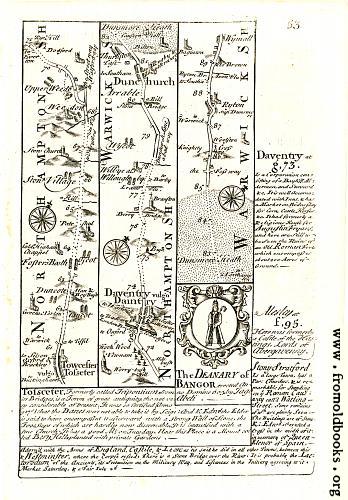
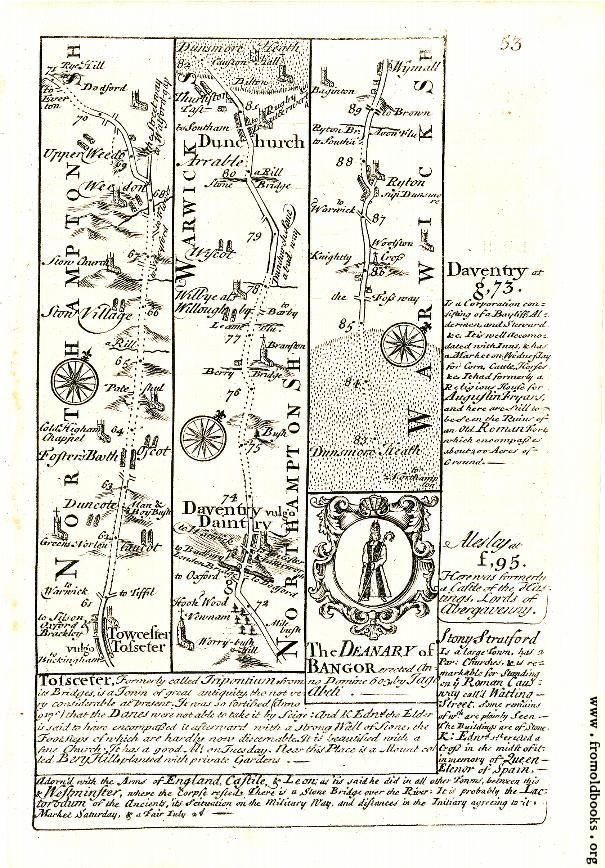
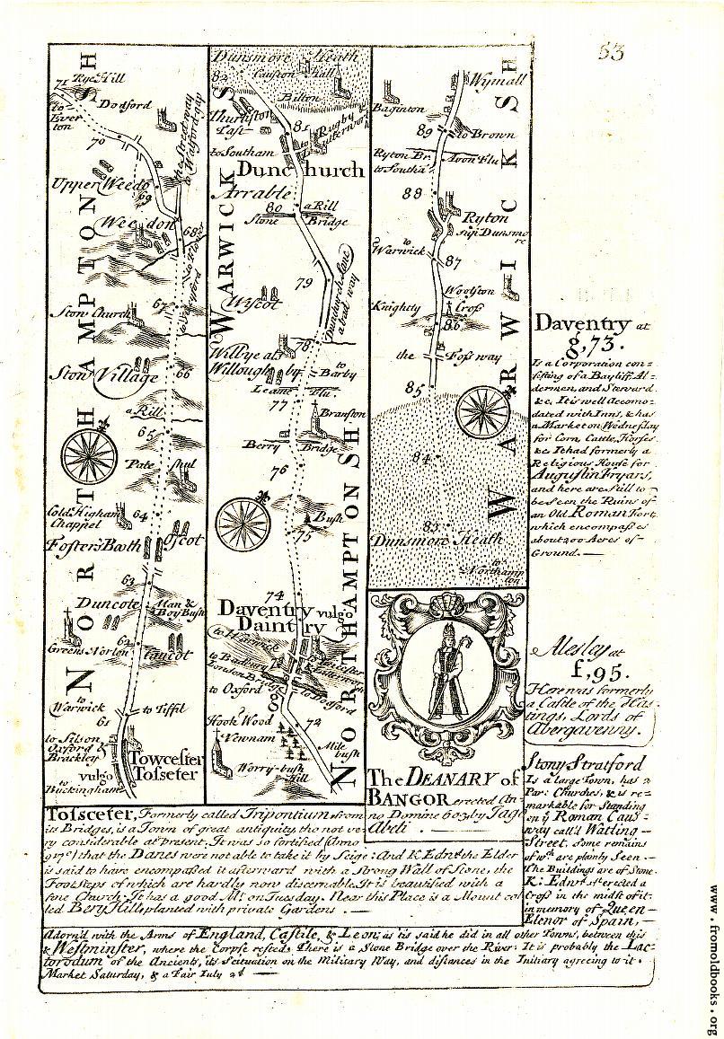
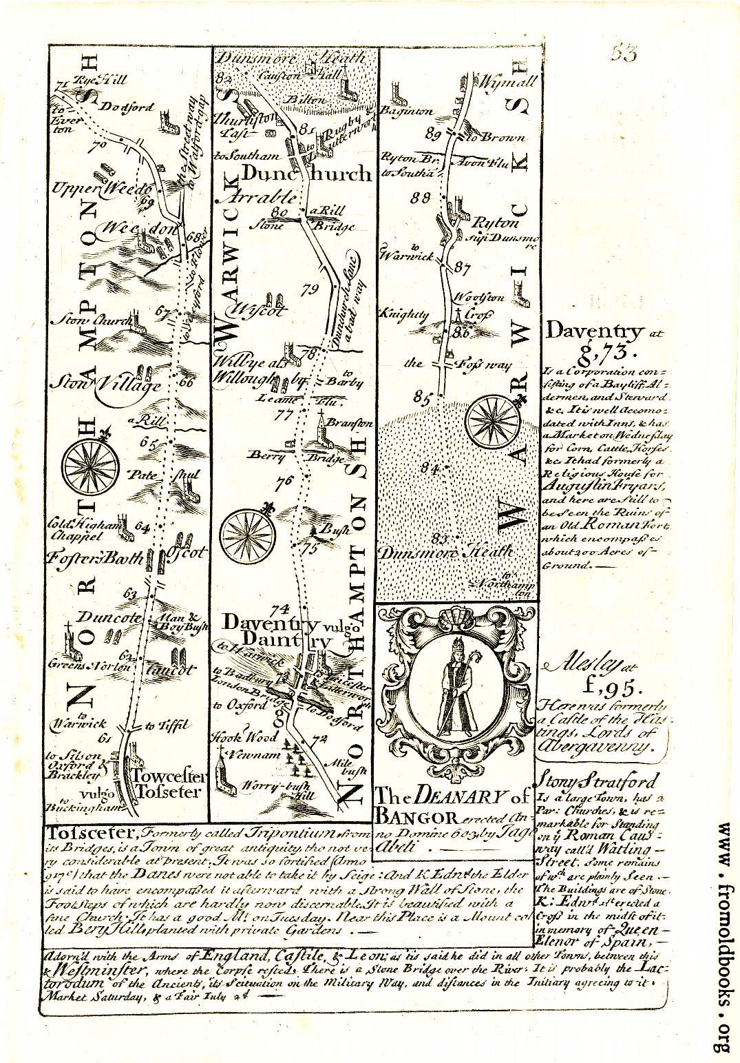
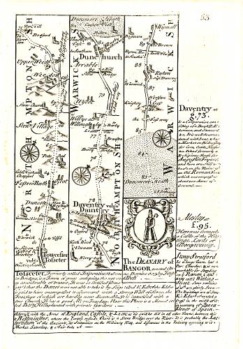
![[Picture: 53.—Towcester, Dunchurch, Daventry]](https://www.fromoldbooks.org/Bowen-BritanniaDepicta/pages/053-Daventry/053-Daventry-q75-605x868.jpg "[Picture: 53.—Towcester, Dunchurch, Daventry]")
Download
Buy print-size file for commercial or other use
| 348x500 | 57K | jpg free download |
| 120x172 | 7K | jpg free download |
| 139x200 | 8K | jpg free download |
| 605x868 | 160K | jpg free download |
| 806x1157 | 270K | jpg free download |
| 1075x1543 | 407K | jpg free download |
Buy print-size file for commercial or other use
| 348x500 | 57K | jpg free download |
| 120x172 | 7K | jpg free download |
| 139x200 | 8K | jpg free download |
| 605x868 | 160K | jpg free download |
| 806x1157 | 270K | jpg free download |
| 1075x1543 | 407K | jpg free download |
This is a route-map for people traveling in Great Britain; an early travel guide from 1720.
The route goes from Towcester (spelt “Tosceter”) through Duncote (Northamptonshire), Fosters’ Booth, Oscot, Cold Higham Chappel, Pateshul, Rill, Ston Village, Weedon, Upper Weedon, Dodford, Worry-bush Hill, Newnham, Daventry, or “Daintry,” Bush, over Berry Bridge, Wilbrye or Willoughby, Wiscot, into Warwickshire over a stone bridge at Rill, and thence to Dunchurch.
From there it goes through Dunsmore Heath along the Foss Way into Woolston Cross, Ryton (or Dunsmore), and thence to Wymall.
The Deanery of Bangor is also illustrated.
I have also scanned the other side of this page.