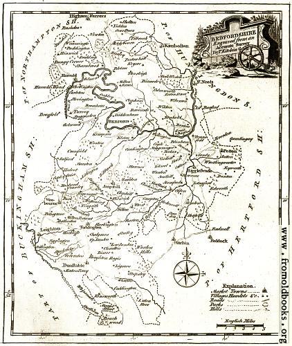
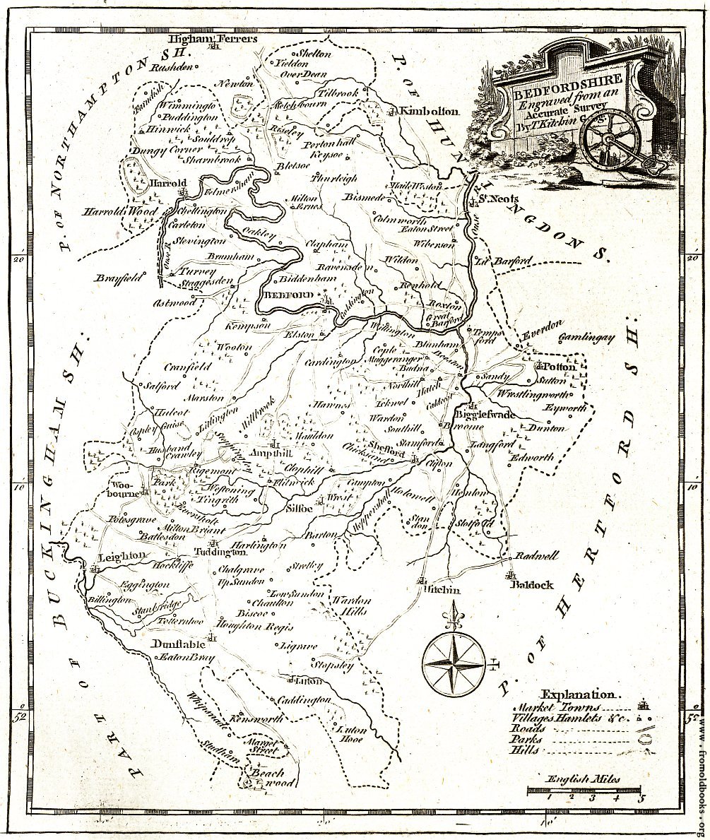
![[Picture: Antique Eighteenth-Century Map of Bedfordshire]](https://www.fromoldbooks.org/Boswell-Antiquities/pages/Bedfordshire-Map/Bedfordshire-Map-q67-2009x2378.jpg "[Picture: Antique Eighteenth-Century Map of Bedfordshire]")
Download
Buy print-size file for commercial or other use
| 422x500 | 67K | jpg free download |
| 120x142 | 7K | jpg free download |
| 169x200 | 11K | jpg free download |
| 753x892 | 237K | jpg free download |
| 1005x1189 | 382K | jpg free download |
| 2009x2378 | 741K | jpg free download |
Buy print-size file for commercial or other use
| 422x500 | 67K | jpg free download |
| 120x142 | 7K | jpg free download |
| 169x200 | 11K | jpg free download |
| 753x892 | 237K | jpg free download |
| 1005x1189 | 382K | jpg free download |
| 2009x2378 | 741K | jpg free download |
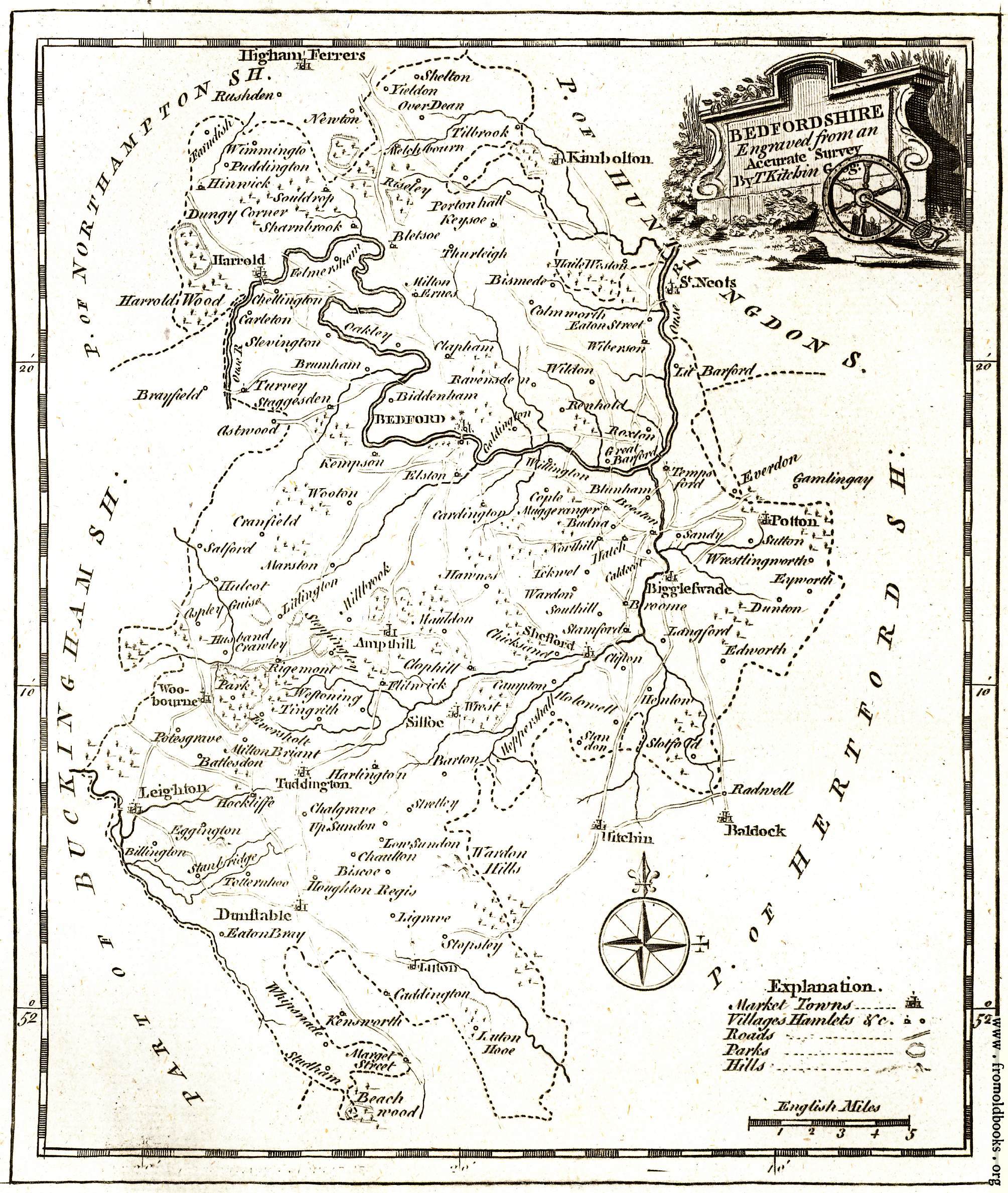
BEDFORDSHIRE
Engraved from an
Accurate Survey
B T Kitchin Geog.
And here on this old map are the names so familiar to me as a child (my father was the Vicar of Haynes, here marked Hawnes, for many years). But of course the names are not all the same as today.