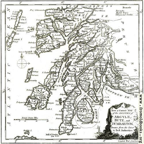
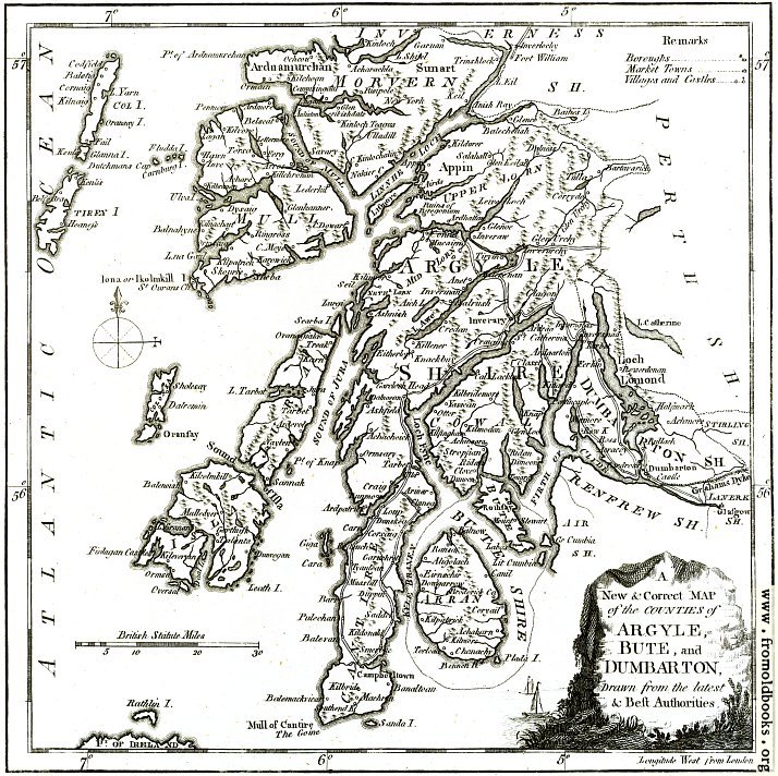
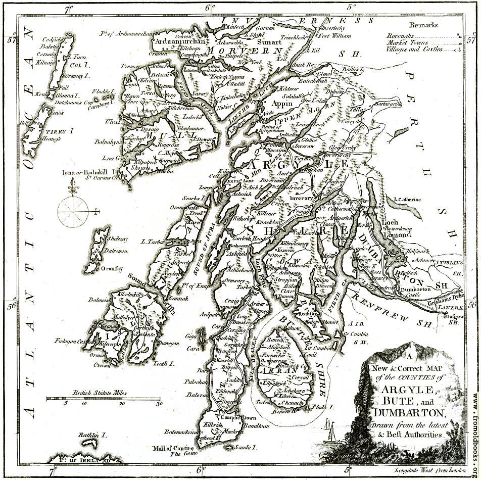
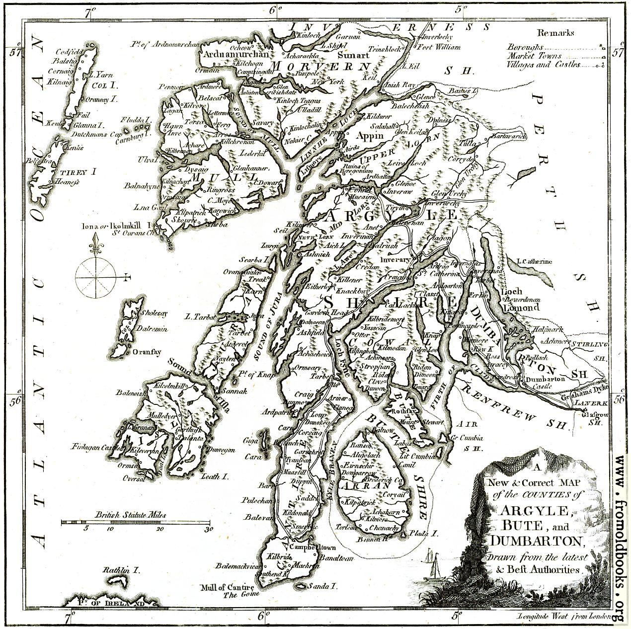
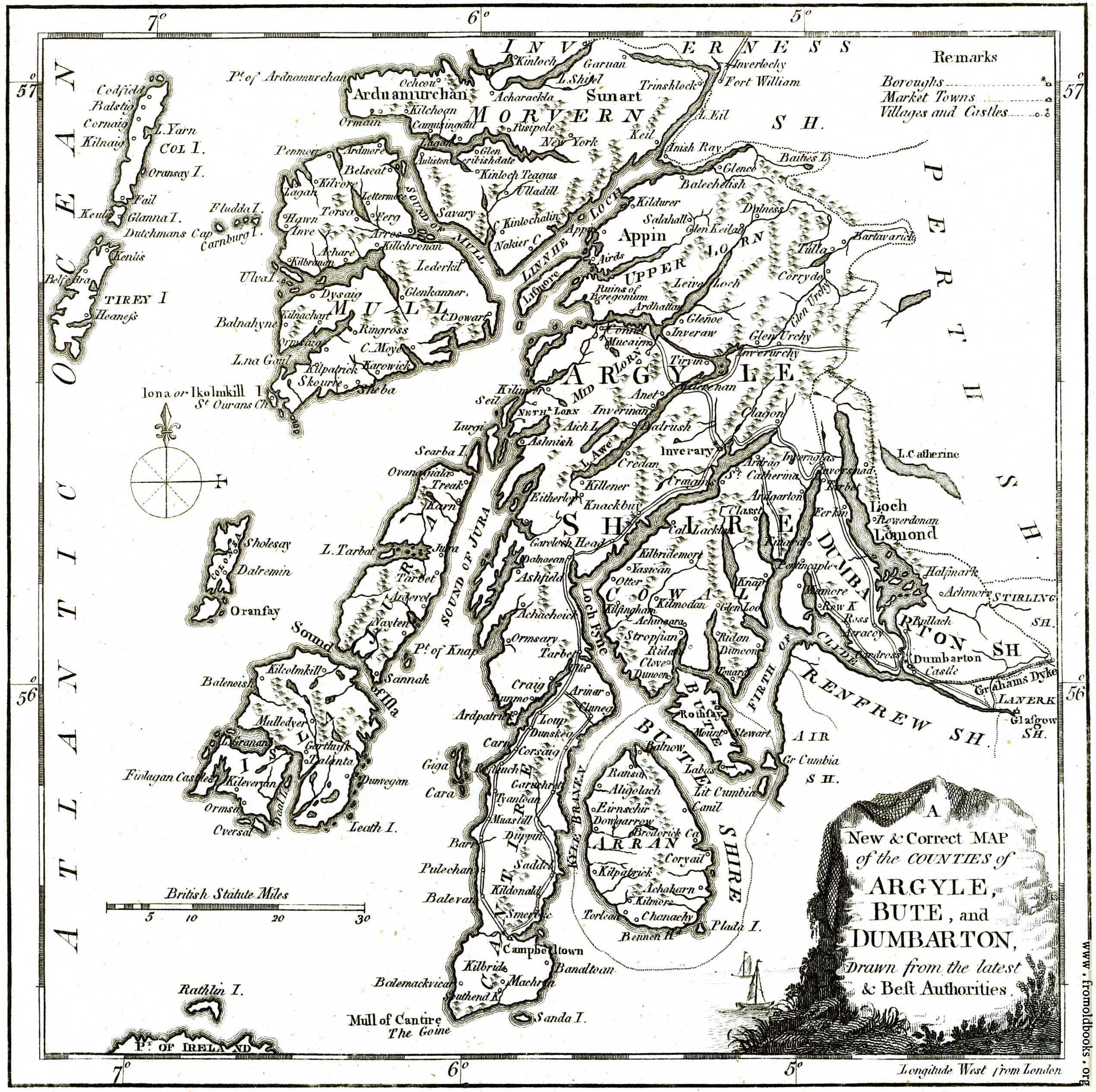
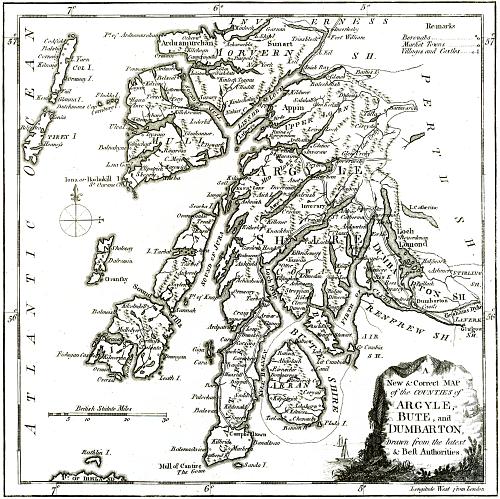
![[Picture: A New & Correct MAP of the Counties of Argyle, Bute and Dumbarton]](https://www.fromoldbooks.org/Boswell-Antiquities/pages/Argyle-detail-Map/Argyle-detail-Map-q85-714x712.jpg "[Picture: A New & Correct MAP of the Counties of Argyle, Bute and Dumbarton]")
Download
Buy print-size file for commercial or other use
Buy print-size file for commercial or other use
A New & Correct MAP
of the COUNTIES of
ARGYLE,
BUTE, and
DUMBARTON,
Drawn from the latest
& Best Authorities.
This is part of an antique map from 1786. The original map was probably a fold-out, and had two parts; this is the right-hand side, and there is also adjoining a Map of the Western Isles.